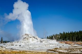
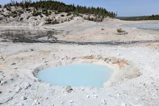
Yellowstone National Park experiences heavy rain and snowfall each year, typically during the winter and spring. While most of that water tends to eventually flow into the surrounding rivers, some of it seeps into the ground, eventually flowing into the hot springs and other thermal features.
How that water reaches those features can vary. A recent study by the United States Geological Survey (USGS), published in Geochemistry, Geophysics, Geosystems, examined the flow of groundwater in Yellowstone and the time it takes for that water to reach a hydrothermal feature by looking at the water’s “fingerprints.”
Read More: One of the Oldest Organisms on Earth Thrives in Yellowstone’s Scalding Hydrothermal Features
How Water Moves Through Yellowstone
All water molecules are made up of two hydrogen atoms and one oxygen atom. But these atoms can have different levels of isotopes. This means that the atoms have the same number of protons but a different number of neutrons, which can result in atoms having a different atomic mass.
Why does this matter? These differences in atomic masses are easily measured in a laboratory. With these measurements and a process known as fingerprinting, researchers can then track how and where water moves through the ground.
Tracking Underground Water
For this recent study, USGS researchers collected water samples from water reservoirs around the park, including from snow, hot springs, and rivers. From the samples, the research team identified the isotopes in the hydrogen and oxygen atoms. They also identified concentrations of tritium, a rare and radioactive isotope of hydrogen.
Tritium cannot be absorbed through the skin and isn’t overly harmful, unless consumed in high amounts. Because tritium decays radioactively, its concentration, especially in water, reduces over time. This makes it especially helpful for determining when water seeped into the ground.
The USGS research team used the information gathered from the water samples to pinpoint the origin of water in specific features and estimated how long it took for that water to reach a feature.
Undercover Water Flow
The study results found that water in hot springs is mostly recharged through permeable tuff units — compacted ash. Most of this water is found along the volcanic plateau and in the margins of the Yellowstone Caldera.
The groundwater in the Upper and Lower Geyser Basins flows through rhyolite units, which are older and deeper compared to the flows near the hot springs in the caldera margins.
The team noted that the samples collected from rain or snow consistently had varying levels of isotopes and changed frequently, unlike the isotopes in the hot springs, which generally remained the same.
Lastly, the team found that the waters in the central geyser basin were recharged with water present before thermonuclear weapons testing in the 1950s and 1960s. During that period, there were higher concentrations of tritium in the atmosphere. The features along the caldera margins have higher levels of tritium than features like Old Faithful do within the central geyser basin.
The results indicate that faster-moving groundwater makes its way into the caldera margins, while slower-moving groundwater eventually finds its way into the central geyser basin.
The study authors also note that these findings indicate that there is more water under the park than previously thought, and that it can take decades for that water to reach the surface.
Read More: Yellowstone Bison Meets Tragic End at Hot Spring, Showing the Danger of Hydrothermal Features
Article Sources
Our writers at Discovermagazine.com use peer-reviewed studies and high-quality sources for our articles, and our editors review for scientific accuracy and editorial standards. Review the sources used below for this article:
- USGS. How does water from snow and rain get to the numerous hot springs in Yellowstone?
- Geochemistry, Geophysics, Geosystems. The Systematics of Stable Hydrogen (δ2H) and Oxygen (δ18O) Isotopes and Tritium (3H) in the Hydrothermal System of the Yellowstone Plateau Volcanic Field, USA
- USGS. Irving Friedman Pioneer Global Water Cycle Yellowstone's Magma Hydrothermal


