We have completed maintenance on DiscoverMagazine.com and action may be required on your account. Learn More

Mars Exposed by Mars Reconnaissance Orbiter

NASA scientists prepare for an unprecedented look at the Red Planet's ancient seas and modern ice fields—key sites in the ongoing search for life.

By Fred Guterl
Oct 10, 2006 5:00 AMNov 12, 2019 5:05 AM

Newsletter

Sign up for our email newsletter for the latest science news
 

You've got the tent tied to the roof of the van, the kids strapped into the backseat, and you've hit the highway. Where's the campsite? You know it's somewhere in the state of Wyoming, but all you have to go on is a highway map and a beautiful photograph. Let's see—there's a campfire pit, some pine trees, and a nondescript mountain in the distance. Any minute now, the kids will start screaming.

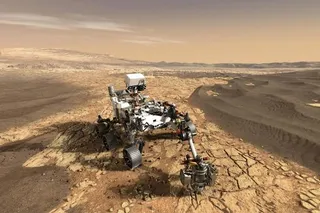
The NASA scientists charged with planning Mars outings face a similar lack of information. Three orbiters have mapped the planet, and three rovers have inched over tiny patches of terrain. Yet scientists still don't have enough data to pick the ideal destinations for tomorrow's robotic or human explorers. Mars is a big place—its surface area is the same as Earth's, minus the oceans. Where are the best spots to find evidence of Martian life? Where might water be lurking just below the surface? More pragmatically, how can the next lander avoid crashing into a giant boulder? To answer such urgent questions, scientists need exponentially more data than they have collected so far.

Gathering that data is the mission of the Mars Reconnaissance Orbiter, or MRO, a 4,800-pound probe now in elliptical orbit around the Red Planet. "We want the ability to get context and zoom in," says Richard Zurek, MRO project scientist at the Jet Propulsion Laboratory in Pasadena, California. The first step is to reach a tight, circular path around the planet. The spacecraft is using an innovative technique called aerobraking, plowing through the thin upper atmosphere and using aerodynamic drag to fine-tune its orbit. Provided the MRO doesn't fry in the process, by the end of this month it will begin gathering images of the Martian surface in unprecedented detail (the images shown here are part of a sneak preview released by NASA when MRO first arrived at Mars). It will capture features as small as a foot across, peer yards below the surface to uncover hidden sediments, fathom the atmosphere, and gather images in a wide range of colors, from visible to infrared light, to reveal the nature of the surface minerals. "All this is to better understand the planet scientifically," Zurek says, "but also to identify those places where the next set of missions going to the surface can be used in the best possible ways."

The centerpiece of MRO is the 150-pound High Resolution Imaging Science Experiment, or HiRISE, the largest and most capable camera ever sent beyond Earth orbit. Whizzing 200 miles above the Martian surface at 2.2 miles per second, it will pick out finer surface details on Mars than commercial satellites can show us on Earth, where cameras have to ride twice as far above the ground to avoid our planet's thicker atmosphere. HiRISE will focus in on only 1 percent of the surface—a breadth similar to other high-resolution orbiting cameras—but will zoom in at five times the resolution of the next-best Mars camera. One mission of HiRISE is to scour seven potential landing zones for a preponderance of rocks larger than about three feet wide, which can wreck a craft upon landing. With HiRISE providing the zoom, the Context Imager (CTX) camera will provide the big picture. CTX will photograph a 20-mile-wide swath of surface at a resolution of 20 feet per pixel, higher than any other orbiting mapper that has visited the Red Planet.

The big prize is evidence of life, past or present. In seeking it, MRO will search out areas where water has played a role in the surface geology or may still remain hidden, perhaps as dirty snow. A good high-resolution camera can find canyons, channels, and other features that may have been formed by water. But determining how such features came to be—were they formed by jets of carbon dioxide or by a gentle spring of water?—requires the ability to analyze the minerals left behind. That's the job of the Complex Reconnaissance Imaging Spectrometer for Mars, or CRISM. CRISM will capture images in 545 different wavelengths, the full spectrum of reflected light, to reveal the chemical fingerprints of surface minerals.

"HiRISE is built to look at shapes in surface features, so it collects all the light and uses it for spatial resolution," says Scott Murchie, the project scientist for CRISM. "We have to collect light over a bigger patch so we can slice it up into many different colors." The color data will tip off scientists to the presence of clays, sulfates, and other minerals that may have precipitated out of ancient lakes. It will also yield the most detailed global information yet on geologic layering, one key to figuring out how Mars evolved over billions of years.

MRO's eyes will examine not only the surface but also above and below it. The Shallow Radar experiment will peer 30 feet or more below the Martian surface to detect buried water ice; another instrument, an infrared radiometer, will monitor dust storms and other atmospheric disturbances. The craft itself will act as an instrument to measure the behavior of carbon dioxide, which is present on Mars both as a gas and as "snow." The trick is to detect minute fluctuations in the planet's gravity field that occur as the mass of carbon dioxide shifts between the atmosphere and the surface. Engineers on Earth will continuously track a radio beam emitted by MRO and monitor its Doppler shift—the elongation or compression of radio waves caused by slight movements of the probe. By factoring out all known causes of the probe's motion (everything from its flight path around Mars to the movement of the crust on which the tracking station on Earth rests), engineers can isolate the perturbations caused by the cycling of Martian snow or smog.

"We can measure a one-part-in-a-billion change in the gravity field," says Maria Zuber, head of MIT's Department of Earth, Atmospheric, and Planetary Sciences and leader of the gravity-mapping team. "That's enough to tell us the difference between summer and winter." Zuber and her colleagues first experimented with gravity-field measurements on the Mars Global Surveyor and are now ready to piece together a detailed atmosphere survey. "When we said we'd do this, nobody believed us. But we did it anyway."

When MRO's mission is complete in November 2008, it will have sent back between 30 and 50 terabits of data—10 times the output of any previous orbiter and twice as much information as in all the words in the Library of Congress. By then NASA will be readying a new rover, the Mars Science Laboratory, to pursue the next round of puzzles. "Every time we've looked at Mars with the ability to resolve things in finer detail, we've seen new phenomena that changed our ideas about how the planet is today and how it has changed," Zurek says. With luck, MRO will discover a few good sites to pitch camp.

1 free article left
Want More? Get unlimited access for as low as $1.99/month

Already a subscriber?

Register or Log In

1 free articleSubscribe
Discover Magazine Logo
Want more?

Keep reading for as low as $1.99!

Subscribe

Already a subscriber?

Register or Log In

More From Discover
Recommendations From Our Store
Shop Now
Stay Curious
Join
Our List

Sign up for our weekly science updates.

 
Subscribe
To The Magazine

Save up to 40% off the cover price when you subscribe to Discover magazine.

Copyright © 2024 Kalmbach Media Co.