A Landscape Burned by Kilauea's Eruption
A flyover a few months post-eruption reveal the destruction left in the Hawaiian volcano's wake.
Dec 27, 2018 6:00 PMFeb 6, 2020 10:56 PM
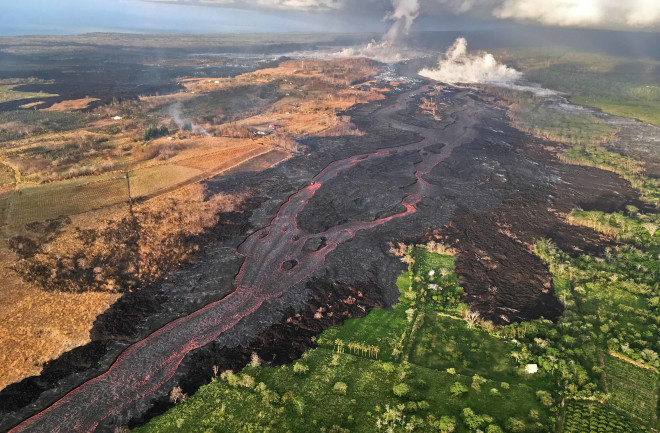
(Credit: USGS Hawaiian Volcano Observatory)
Newsletter
Sign up for our email newsletter for the latest science news
0 free articles left
Want More? Get unlimited access for as low as $1.99/month

Stay Curious
Sign up for our weekly newsletter and unlock one more article for free.
View our Privacy Policy
Want more?
Keep reading for as low as $1.99!
Already a subscriber?
Find my Subscription
More From Discover
Stay Curious
Subscribe
To The Magazine
Save up to 40% off the cover price when you subscribe to Discover magazine.


Copyright © 2025 LabX Media Group