Stay Curious

SIGN UP FOR OUR WEEKLY NEWSLETTER AND UNLOCK ONE MORE ARTICLE FOR FREE.

Sign Up

VIEW OUR Privacy Policy


Discover Magazine Logo

WANT MORE? KEEP READING FOR AS LOW AS $1.99!

Subscribe

ALREADY A SUBSCRIBER?

FIND MY SUBSCRIPTION
Advertisement

New Map Reveals Antarctica’s Gigantic Submarine Canyons — Some Deeper Than 13,000 Feet

Learn about Antarctica’s hidden submarine canyons and how they play an important role in global climate.

Stephanie Edwards
ByStephanie Edwards
Image Credit: Marc Cerdà - University Of Barcelona

Newsletter

Sign up for our email newsletter for the latest science news

Sign Up

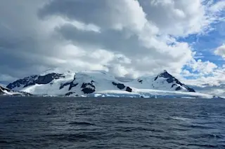
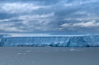
Antarctica is commonly known as the land of penguins, cold temperatures, and is home to about 90 percent of the world’s ice. But did you know that under all of that ice hides miles and miles of underwater canyons?

Thousands of these geological spectacles — known as submarine canyons — exist worldwide, yet scientists have struggled to map and study them, particularly in remote polar regions. Now, the most complete map of the Antarctic submarine canyons has been published in Marine Geology, detailing 332 canyon networks that reach a maximum depth of over 13,000 feet.

“Some of the submarine canyons we analyzed reach depths of over 4,000 meters (13,123 feet). The most spectacular of these are in East Antarctica, which is characterized by complex, branching canyon systems,” said David Amblàs, from the Faculty of Earth Sciences at the University of Barcelona, in a press release. “The systems often begin with ...

  • Stephanie Edwards

    Stephanie Edwards

    Stephanie Edwards is the marketing coordinator at Discover Magazine, who manages all social media platforms and writes digital articles that focus on archaeology, the environment, and public health.

Stay Curious

JoinOur List

Sign up for our weekly science updates

View our Privacy Policy

SubscribeTo The Magazine

Save up to 40% off the cover price when you subscribe to Discover magazine.

Subscribe
Advertisement

0 Free Articles