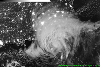
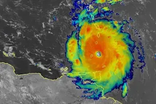
The Suomi NPP satellite captured this photo of Hurricane Irma over Florida at 3:10 a.m. EDT on Sept. 11, 2017. (Click to enlarge. Source: Cooperative Institute for Meteorological Satellite Studies) As Hurricane Irma continued to churn north over Florida early in the morning of Sept. 11, the Suomi NPP spacecraft passed overhead and sent back this dramatic image. In the image, acquired by a nighttime sensor called the "Day/Night Band" on the satellite's VIIRS instrument, the hurricane is illuminated by the relatively faint light of the moon. But the image reveals more than that. "In addition to the cloud structures, this band can help identify power outages," writes Scott Lindstrom in the satellite blog of the Cooperative Institute for Meteorological Satellite Studies. "Tampa and Miami city lights are still visible. Key West is dark."
Part of the Florida Keys at 3:10 a.m. on Sept. 11, 2017. (Source: CIMSS Satellite Blog) ...


