Antarctica's Hot Spot

Braving hurricane winds and 40-foot waves, scientists struggle to unerstand Antarctic warming.

By Mary Roach and Gary Braasch
Nov 1, 1999 6:00 AMNov 12, 2019 4:12 AM

Newsletter

Sign up for our email newsletter for the latest science news
 

Not many ships venture into the Drake Passage, 500 miles of heave and blow between the fjords of southern Chile and the tip of the Antarctic Peninsula. At these latitudes, there is nothing but icy cold ocean, 360 degrees of it. With no landmass to break the wind's fetch, a ship can expect to run into waves that are two, three, even five stories high. Sailing crews consider these the most treacherous seas on the planet.

This afternoon, the Drake is living up to its reputation. As near-hurricane-force winds slam growing swells into the research vessel Nathaniel B. Palmer, scientists below deck scurry to lash down computer terminals and plaster lab equipment with bubble wrap. Off the starboard side, a cavalcade of hulking waves begins to line up, each ready to take a nice swing at the ship. Deck hands pelted by frozen sea spray and snow stagger like drunks. The barrage of these ice bullets comes in horizontal, so fierce it’s impossible to keep my eyes open for more than a moment. But in that moment, I have the unfortunate luck to glimpse the frenzied ocean over my shoulder. I have read that people drown in seas like these because there’s so much wind-whipped water in the air that even if you can keep your head above the surface, you cannot draw a breath. Of course, if unprotected by a suit, you’ll lose consciousness in seas this cold after one and a half minutes anyway.

On the bridge deck, Second Officer Paul Jarkiewicz tells stories. He recalls a brutish wave that once hurled the entire chart table out of its mounts and down the hall. At one time, the marine projects coordinator was sighted on the aft deck, clinging to equipment, his legs blown straight out behind him like a flag in the wind. Eventually, of course, his conversation turns to the fear that lurks in the consciousness of every sailor who ventures into these waters: the rogue wave scenario. In a storm at sea, wind-driven waves line up perpendicular to the wind’s direction. The helmsman can steer the ship to take the waves head on, the bow pointed right at the heart of the wind. Or he can maneuver the ship to take the waves “broad on the bow,” at a 45-degree angle. Ships are designed to withstand seas taken that way. But one in every 10,000 waves or so doesn’t get the message to line up with the others. That so-called rogue wave comes at the ship from a completely unexpected direction, from the side or from aft. “Rogue wave comes along and breaks a ship’s back,” says Jarkiewicz, fiddling with his radar controls. “She’s gone in a matter of minutes. And so are you.”

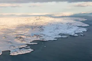
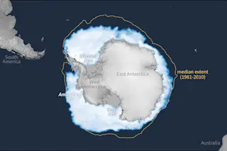
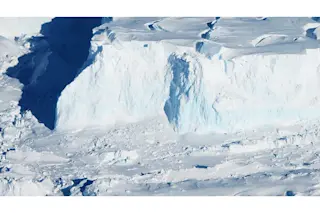
So what kind of science is done at the risk of having men and women swept overboard and a $TK-million ship lost at sea? What could be as important as the lives of the 60 people on the Nathaniel B. Palmer? In short, the future of the planet. The one we live on. The ultimate goal of this trip is to gather clues about global warming. But the more immediate goal concerns a regional warming trend in Antarctica. Nobody knows exactly what this trend means for the rest of the world, but the western side of the Antarctic Peninsula is warming up faster than any place on earth. Comparisons of climate records from just a half-century ago show that temperatures here have risen, on average, 21/2 to 3 degrees Celsius. Between 1966 and 1989, most of the Wordie Ice Shelf, 502 square miles, disappeared. And over the past 18 months, two of the peninsula’s largest ice shelves, the Larsen B and the Wilkins, have lost nearly 1,100 square miles of their total area, a sheet of ice about the size of Rhode IslandCK. That’s five to ten times the average annual loss over the past 10 years. At that rate, much of the Wilkins ice shelf will be gone in a few years, says glaciologist Ted Scambos of the University of Colorado at Boulder. “Nobody expected it to happen this fast.”

Although very few scientists still deny global warming is upon us, no one yet knows how much of it—if any of it—could be due to a recurring natural temperature cycle. The answers to that crucial question lie in the ancient past. And to find those answers, one must go back and look at what was happening with temperatures hundreds to thousands of years ago. One way to do that is by studying long-buried, centuries-old marine sediment: mud from the ocean floor.

And so a team of marine sediment experts has set up shop on the Nathaniel B. Palmer, hoping to sink great hollow cores deep into the ocean off Antarctica. It is a pilgrimage some of them have been making for over a decade. Nothing about this kind of research is easy—not the getting there, not the doing. Sponsored by the National Science Foundation’s Office of Polar Programs, the scientists will spend two weeks on board. If all goes well, they will haul up 10-, 20-, and 80-foot columns of green muck. It will tell them the story they’re looking for: the story of ancient climates. For the ocean floor is a record, an eons-old accumulation of whatever has sunk down through the water to the bottom of the sea.

What sinks to the ocean floor depends in part on how warm the climate is. When it’s cold enough to form ice shelves that extend over the Antarctic land mass and into the ocean, much of what drops to the seafloor is sand and gravel that the glacier has picked up on its slow march from the continent’s ice cap. Sandy ocean sediment is associated with ice cover, and when you find it somewhere far from the ice edge, you know that at some point the ice reached that site. When the weather warms and no ice sits upon the seas, the sediment on the ocean floor is mainly organic: remains of plankton and diatoms. By reading the ups and downs of organic versus nonorganic sediment in a core, sedimentologists can follow the retreats and advances of ice over the past 20,000 years. So far, ice cores from Greenland and marine sediment cores from Antarctica show that a notable warming period occurred from 3,000 to 8,000 years ago. Nobody knows for sure why the warming occurred, but researchers suspect that a slight wobble in Earth’s orbit could be responsible. That wobble could have shifted Earth’s position, which might have altered patterns of ocean circulation and climate.

Researchers are more certain about what’s driving the warming trend today. Says Colgate University marine geologist Amy Leventer, one of the chief scientists on this voyage, “I think it’s clear that some portion is due to the sun. But I also think it’s undoubtable that some percentage is due to man.”

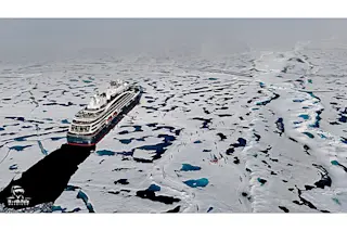
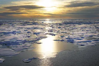
Yesterday’s storm has moved on, leaving behind an unearthly stillness broken only by the calls of snow petrels and the engine’s throaty hum. We have arrived at the mouth of the Muller Ice Shelf, near Lallemand Fjord. For those who picture Antarctica as a monotony of whites and grays, Lallemand Fjord is an awakening. The icebergs crowding the ship this morning are infused with a paint store panoply of blues, many of them arrestingly unnatural, like the bright, blaring blues of mouthwashes and toilet bowl cleaners. It is not merely the variety of hues that dazzles, but the intensity. The color appears to come from within, like the glow in a smoldering piece of coal. It’s a neat optical trick: As ice is compressed over time, it becomes easier for light to pass through it. Pretty much everyone is out on deck, looking at the ice.

Not all of them are thinking nice thoughts about it. Gene Domack, a sedimentologist from Hamilton College in Clinton, New York, and the trip’s other chief scientist, is one example. He and graduate student Asa Chong left a series of ocean sediment traps moored in the water here last year, to be recovered this morning. “The ice shelf has advanced over the tops of the traps,” says Domack, fairly chewing on his moustache. Chong’s traps were left close to the edge of the ice shelf intentionally. If you are planning to study the advance and retreat of ice shelves over the millennia, you need to be able to recognize the unique sediment profile of an ice edge. A more detailed familiarity with one year’s worth of sediment (generally about 7 to 12 inches) also helps scientists interpret the timetable of the longer cores.

As it turns out, the ice shelf hasn’t covered the traps after all. But huge chunks of ice, some the size of a bus, have broken off the shelf. Maneuvering the ship around these dangerous hulks without colliding with them is tricky. Using the Global Positioning System measurements taken from last year’s trip, the crew moves into position to confirm the traps’ location by sonar. Once a trap is pinpointed, the crew tries to snag it on a grappling hook lowered over the back of the ship. For the next half-hour, the ship cruises slowly forward and back, like a police rig dragging for a corpse. Eventually, the sediment traps, looking just like brightly colored upside-down traffic cones, are hooked and hauled aboard.

Domack withdraws the sample from trap Number 4, and points to the ice cream sundae layering of dark and light browns in the clear plastic cylinder. “Look at those varves!” marvels a graduate student, admiring the seasonal layers. Together, these bands are the fingerprint of a calendar year at the ice’s edge.

Within a few days the Nathaniel B. Palmer reaches Paradise Harbor. Out on deck in the crystalline Antarctic sunlight lie the remains of last night’s Jumbo Piston Core: a 10-foot length of pipe, now bowed like an elephant bull’s tusk. When it went over the side of the ship, it was straight. Apparently it hit a hard spot. While the crew heads off to shore for a brief rest, Domack alone remains on board, pouring over a sonar map of our next destination. The map helps him decide precisely where to sink the core. As no ready-made maps of the area’s seafloor exist, the Nathaniel B. Palmer has been generating its own. The ship is equipped with a SeaBeam system, which bounces a sonar signal off the ocean floor while tracing a back-and-forth swath over the area like a lawnmower. This technique, first developed by the military in the 1960s to identify submarine locations with pinpoint accuracy, allows oceanographers to map the seafloor with as much detail as the moon.

Domack points to a light-blue area the size of an almond on one of last week’s maps. “What we’re looking for is small pockets like this one.” Such sites lie deeper than most of the area’s sea shelf, putting them out of reach of the dragging bellies of icebergs, where they remain undisturbed for millennia. Nor is the pocket all the way down at the bottom of the basin. “The big basins capture all the sediment that is swept off the high regions around the shelf,” says Domack, “and that makes the signal very noisy.” What Domack wants is a clear signal, and to get that, he needs to pull up a sample that reflects only what’s dropped down from the water column directly overhead. Augmenting the SeaBeam map is a readout that gives a cross section of the sediment layers below the seafloor. To avoid situations like last night’s Jumbo Core-bender, the scientists look for softer, less compressed sediment. Domack points to a half-inch band of pronounced striping on the readout: our target.

Once we have closed in on the spot, it takes six workers six hours to assemble and launch a core. The task is risky and dirty and exhausting. Eight 200-pound lengths of steel piping are carted to the ship’s railing and coupled together to create a pipe 80 feet long and five inches wide. Then the captain issues a storm warning: rough seas, 30- to 40-knot winds. Snow is swirling in the ship’s lights, thick as gnats. The weather report has put everyone on edge. If the winds pick up to 35 knots, Barney Kane, the marine projects coordinator, will order everyone inside.

Tonight is Domack and Leventer’s last chance to attempt an 80-foot core sample. Tomorrow we head back to Chile. With the pipe segments coupled at last, it’s time to slide in the plastic liner segments. If all goes as planned, these will emerge four hours later, crammed like sausage casings with grade-A, olive-drab Antarctic mud. The first two go in easy. By the eighth section, the combined weights of the seven already in have three of the men heaving en masse. They look like the flag-raising soldiers on Iwo Jima. The wind is laying into the waves. The snow is coming down so hard it looks like a fan-blown blizzard on a Hollywood set.

Meanwhile, on the far end of the deck, the crew hauls in a 12-foot kasten core. Since the impact of a Jumbo Piston Core blasts apart the top few feet of mud, a smaller, gentler core is sent down to bring up an undisturbed first few feet. The kasten core is also a dress rehearsal: If it comes up full of mud, it’s all systems go on the Jumbo Piston Core. The top of the kasten core emerges from the sea with water streaming from a pair of small holes in its sides: a bad sign. The group gathers round as the core is opened; a pathetic green lump of mud drops to the deck. From beneath a battered hard hat, Leventer looks on, more exhausted than upset. She’s been up for 19 of the past 24 hours. “We don’t have time to do another kasten core,” she says. “The weather’s getting really bad.” She signals the deck crew to go ahead with the Jumbo Piston Core. “If we lose it, we lose it.”

A crane lifts the pipe off the railing, and the crew pushes it out far enough to clear the ship. With one pull of a quick release, the pipe swings down into the sea. Then it’s lowered by winch and cable over 2,000 feet. About 10 feet from the seafloor, a trigger core hits bottom and releases the main core, which drops the remainder of the way by gravity and buries itself in the mud. For the pullout, the action moves to the Aft Control Winch Station, a window-lined office above the deck. A video monitor displays the stress being put on the winch cable—13,000 pounds and counting. Chief engineer Dave Munroe fiddles with a bolt as he watches the cable readout. “I’ve seen it snap. Left a big S on the side of the ship where it hit.” A half-hour later, the head of the core pops up over the side of the deck. It’s coated like a mud wrestler in green slime. Smiles appear and the relief is tangible. The captain shakes Domack’s hand. The core, says Domack, is the longest ever recovered from the Antarctic continental shelf.

Finally, we head home. Antarctica is a shrinking band of white on the horizon. Domack is standing out on deck, taking a break from packing up the lab. The sediment cores have been stacked in the science cooler, soon to be on their way to an analysis and storage facility in Florida. A preliminary shipboard analysis of their magnetic profiles has Domack walking on air. Not only do they verify the larger core done in 1992, but also they provide a more detailed record of certain key shifts in climate. “Now we’ll be able to understand how rapidly these climate transitions took place,” says Domack, “and what processes were involved in making that environmental change.” The ship dips low in the trough of a swell. For a moment there is nothing but sky and ocean. Something about journeying on the open seas stirs up a feeling of human connection with the planet. I imagine that this adds, somehow, to the sense of urgency that must underlie Domack and Leventer’s work. I turn to ask Domack about this, but he is gone, back inside to his boxes and maps and data logs, small things that may one day save this big Earth.

1 free article left
Want More? Get unlimited access for as low as $1.99/month

Already a subscriber?

Register or Log In

1 free articleSubscribe
Discover Magazine Logo
Want more?

Keep reading for as low as $1.99!

Subscribe

Already a subscriber?

Register or Log In

More From Discover
Recommendations From Our Store
Shop Now
Stay Curious
Join
Our List

Sign up for our weekly science updates.

 
Subscribe
To The Magazine

Save up to 40% off the cover price when you subscribe to Discover magazine.

Copyright © 2024 Kalmbach Media Co.