

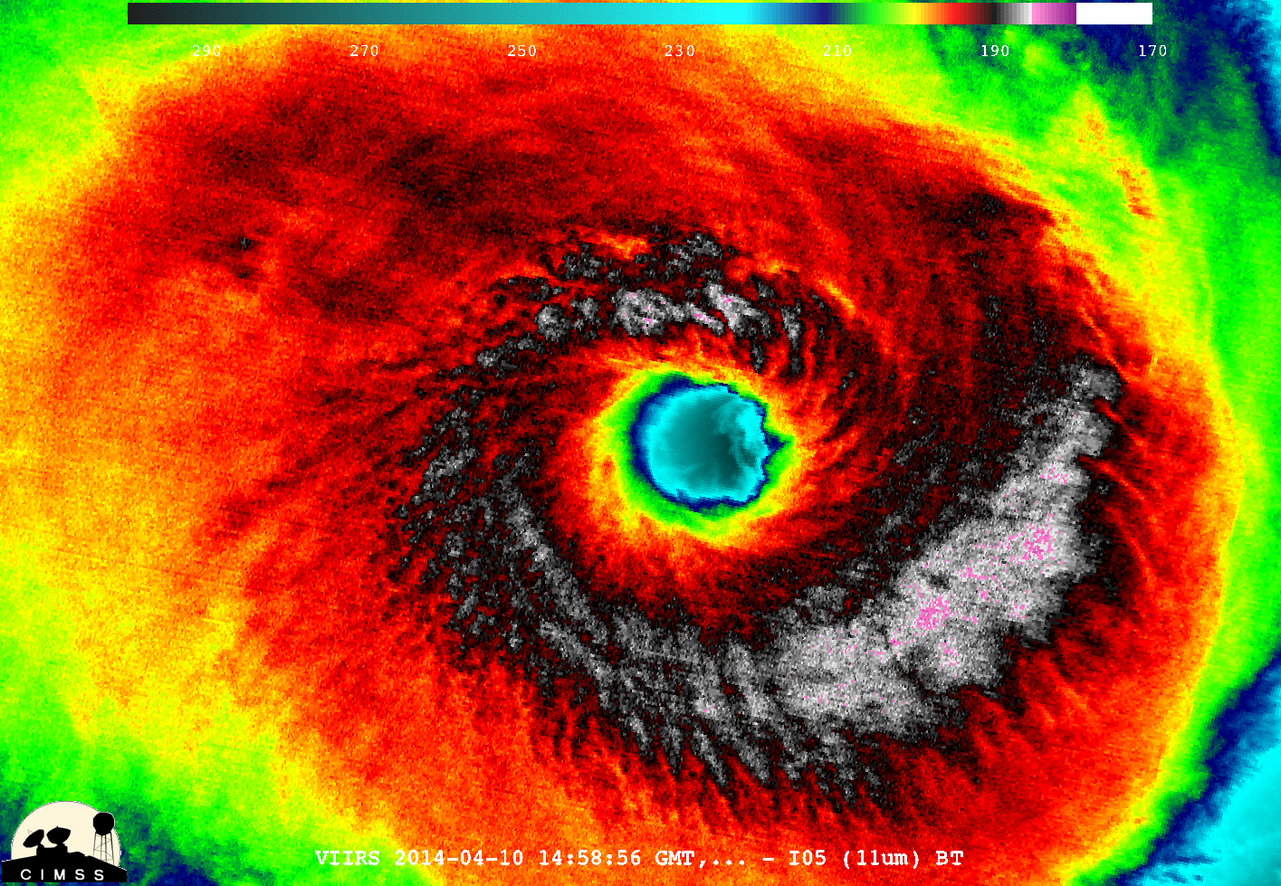
Two satellite images of Tropical Cyclone Ita alternate in this animation. Captured by the VIIRS instrument on the Suomi NPP satellite, the images show the storm just before it made landfall on Australia's Queensland coast on April 11, 2014. (Source: CIMSS Satellite Blog) After making landfall in Queensland, Australia on Friday, April 11 as a category 4 storm, Tropical Cyclone Ita has been lashing coastal areas between Cairns and Townsville with heavy rain and gale force winds, including gusts up to 60 miles per hour. Despite having remained mostly over land since landfall, Ita's cyclonic structure has remained fairly intact, and its center of circulation is still "tightly wrapped," according to the Joint Typhoon Warning Center. Moving south-southeastward at about six miles per hour, the storm is expected to track right along the coast through the weekend before heading back out to sea on Monday. (For Ita's predicted track, click ...
Tropical Cyclone Ita Lumbers Along Australian Coast
Tropical Cyclone Ita made landfall on the Queensland coast as a category 4 storm, unleashing heavy rain and gale-force winds.
More on Discover


Stay Curious
SubscribeTo The Magazine
Save up to 40% off the cover price when you subscribe to Discover magazine.
Subscribe