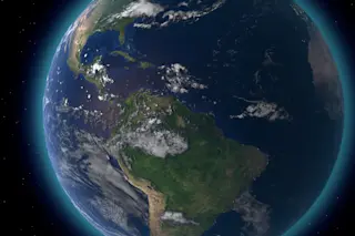
Just before Halloween last year, NASA launched into orbit the improbably named National Polar-orbiting Operational Environmental Satellite System Preparatory Project, which they thankfully shortened to NPP. In its low 800 km (500 mile) orbit it looks down at the Earth to investigate our environment. It only sees a portion of the Earth at any one time, but if you take observations taken during a single day -- say, on January 4, 2012 -- and stitch them all together, you get this magnificent shot:
[Click to engaiaenate, or download the Big McLarge Huge 8000 x 8000 pixel version.] Man, the resolution is so high is like you're actually there. Oh wait. In fact, the biggest version is 8000 pixels across, and the Earth is about 8000 miles wide, so the resolution is about a mile per pixel. We're not seeing the entire hemisphere here, but the view is roughly 8000 km ...


