

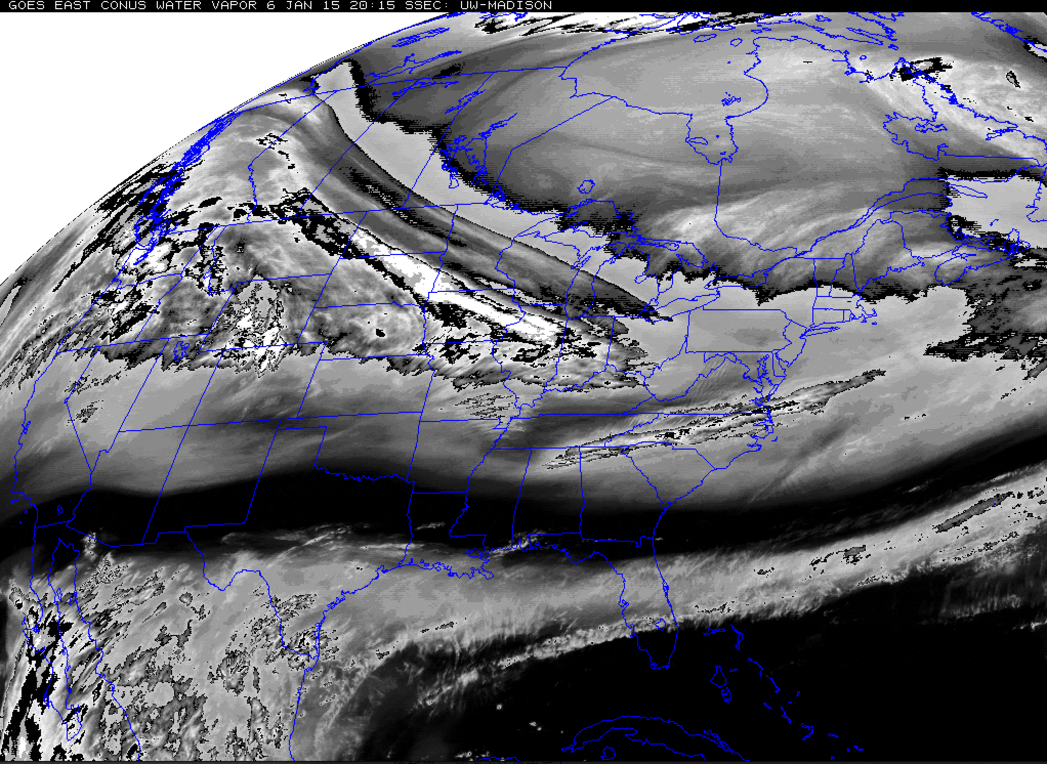
An animation of GOES weather satellite images acquired on Tuesday, Jan. 6, 2015. (Source: NOAA) By now, you've probably heard of the polar vortex. But how about the Arctic streak? I just made that up, based on the animation above of GOES weather satellite images showing water vapor in the atmosphere streaking out of Canada from the northwest, down across the Upper Midwest and toward East Coast. I think it's a pretty good description of that elongating, well, streak. This clipper system ushered in an extraordinary dome of high pressure and bone-chilling Arctic air, which will be affecting millions of people this week. To offer just one example, as I'm writing this late Tuesday night, temperatures in Minneapolis are expected to plunge to minus 10 degrees F — and with 25 mile per hour winds, the wind chill will drop to minus 35. The Weather Underground's new blogger, Bob Henson ...
The Arctic Streak
Discover how the polar vortex shapes winter weather, bringing Arctic air and extreme cold across the country.
More on Discover


Stay Curious
SubscribeTo The Magazine
Save up to 40% off the cover price when you subscribe to Discover magazine.
Subscribe