Google Street View can pretty much show you every location in the world, even the Faroe Islands thanks to camera-yielding sheep, from the ground. While Satellite View shows us a large-scale aerial of the world, what about what’s in between?
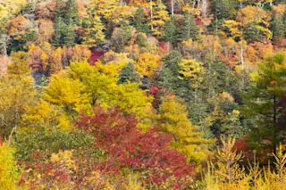
Gregory Crutsinger, a scientist who’s worked for drone companies like 3D Robotics and Parrot, recently started a UAV consulting company called Drone Scholars and is leading a citizen scientist drone project called Fly4Fall. The project’s goals: to survey fall leaves across the world and test crowdsourcing drone data. The bigger goal: to create Google Street View in the sky with drone images.
Drone tech has helped researchers discover a lost city and monitor polar bears in the Arctic. Crutsinger also says drones can be useful for studying biogeography, or the distribution of species. But why turn to regular ol’ drone owners to do what scientists could easily do with their ...


