Something is stirring in the tropical Pacific Ocean, and by fall it may begin to disrupt weather patterns worldwide.
For weeks now, a blob of cold water has been rising from the depths along the equator, and lately it has been helping to cool off a broad swath of the surface stretching from South America to the central Pacific.
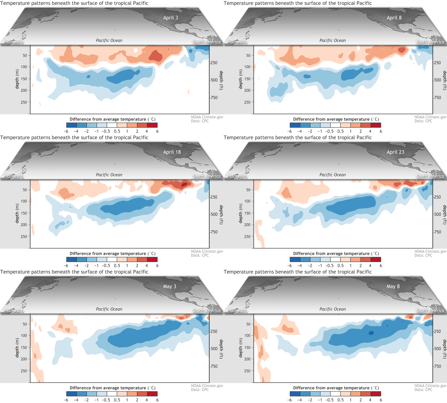
This cross-section of a portion of the tropical Pacific Ocean shows how temperatures have departed from average between early April and early May 2020. The blue feature is an area of colder than normal water that expands and rises toward the surface over time. (Credit: Climate.gov figure from CPC data)
Climate.gov figure from CPC data
At the same time, the storied trade winds, which helped early mariners sail from the Americas toward Asia, may be getting restless. Forecasters believe they're ready to blow more strongly from east to west along the equator. That would help bring more of the blob's cold water to the surface.
These stirrings, and computer modeling, have prompted the National Oceanic and Atmospheric Administration to issue a La Niña Watch. This means conditions are favorable for its development in the next six months.
La Niña, and its sibling, El Niño, make up one of the most significant climate phenomena on Earth, the El Niño Southern Oscillation (ENSO). Both can have profound influences on weather around the globe.
ENSO is still in its neutral state right now — neither La Niña nor El Niño are in place — and that's likely to continue through the summer. Also, favorable conditions don't mean La Niña is a lock. In fact, NOAA forecasters peg the odds of that happening in the fall and lasting through winter at 50 to 55 percent.
"There is still about a 40-45% chance that neutral conditions will remain through the fall and winter, and a smaller but non-zero chance of El Niño — around 5-10%," notes Emily Becker, a NOAA scientist, writing in the ENSO Blog.
"One of the factors restraining the probability of La Niña in the current forecast is the lack of a substantial source of cooler-than-average water under the surface of the tropical Pacific," she says. Yes, there's that blob — scientists call it an "upwelling Kelvin wave." But it is dissipating.
The odds of La Niña developing would rise if the trade winds do strengthen, stirring up more cold water from the deep and triggering a new upwelling cold blob.
Possible Impacts Around the World
If La Niña does develop, it can have a variety of significant impacts far afield. In North America, it tends to bring increased outbreaks of particularly cold weather from Alaska through much of Canada, and into the U.S. northern tier. It can also bring more storminess to the Pacific Northwest and parts of the U.S. Midwest.
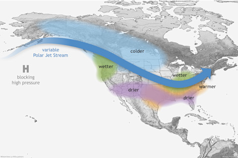
Typical impacts of La Niña in North America. (Credit: NOAA)
NOAA
Meanwhile, the U.S. southern tier tends to go dry during La Niña episodes. This could intensify and spread drought already afflicting New Mexico, Texas, southern Colorado and nearby areas.
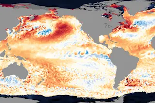
For now, forecasters are watching closely for La Niña — and among other things, they have their eyes fixed on the cool surface waters spreading along the equator. You can see it happening in this animation:
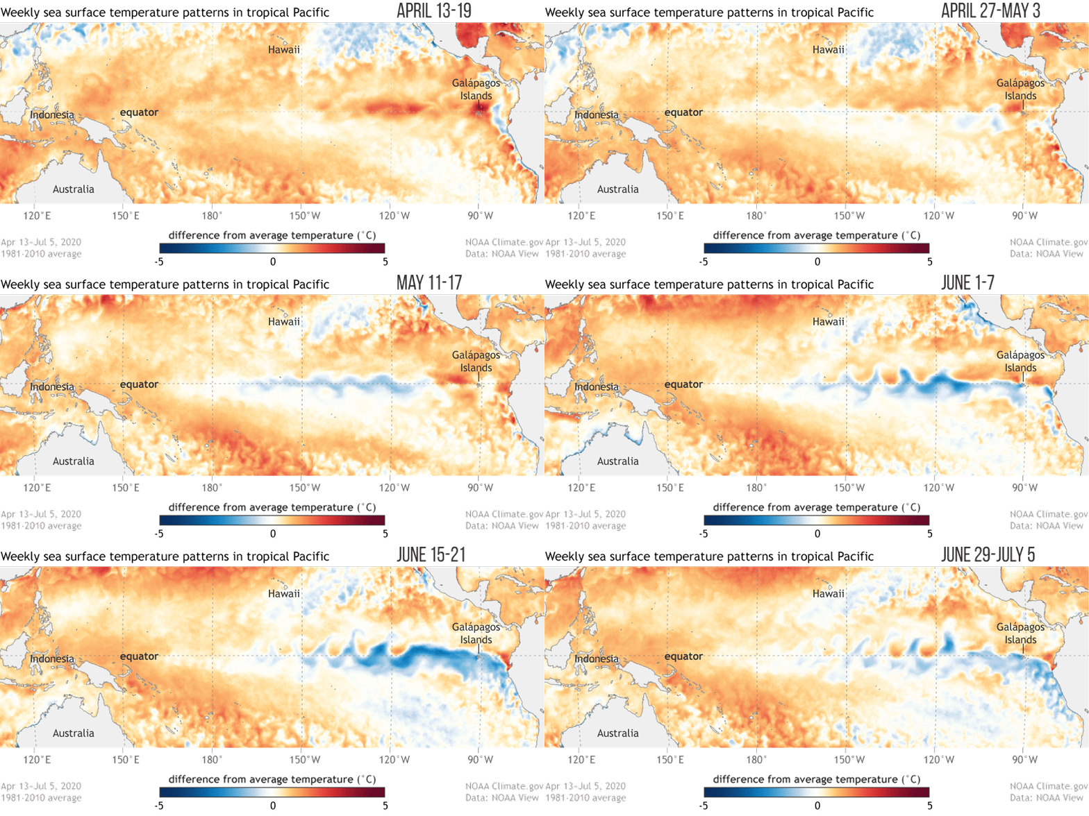
This animation shows how sea surface temperatures in the Pacific departed from the long-term average from mid-April 2020 through early July 2020. Cooler than normal conditions are seen developing along the equator from South America to the central Pacific. (Credit: Climate.gov graphic based on data from NOAA’s Environmental Visualization Lab)
Climate.gov graphic based on data from NOAA’s Environmental Visualization Lab
In particular, they are interested in what's happening in an area of the east-central equatorial Pacific Ocean dubbed the "Nino 3.4 region." Taking into account what's happening in the ocean and the atmosphere right now, most of the forecasters' models are predicting that sea surface temperatures there will cool to more than 0.5°C chillier than the long-term average in the fall and winter.
Why is that number significant? For a La Niña to be declared, average sea surface temperatures in the region must be at least that much cooler than average in the preceding month. Other criteria involving the trade winds, and shifts in cloudiness and rainfall, must be met, too. (For the gory details, check this out.)
Lastly, if you're wondering about the curious wavy pattern in the cooler-than-average surface waters visible in the animation above, they're called "tropical instability waves." In a nutshell, here's what causes them:
As the surface waters have been cooled under the influence of the rising blob, they've been spread to the west by the trade winds. And as this has occurred, they've mixed with warmer water just to the north and south of the equator. The wavy pattern is the result of that movement and mixing. For more detail about this process, see Emily Becker's excellent explainer at the ENSO Blog.
For now, it's wait and see what the sea (and atmosphere too) will do.


