We have completed maintenance on DiscoverMagazine.com and action may be required on your account. Learn More

The World's Biggest Tornado Hunt

Next month, 100 meteorologists will try to finally understand the dynamics of tornadoes—like the one that killed three people in Mena, Arkansas, last night.

By Leora Frankel
Apr 10, 2009 5:00 AMNov 12, 2019 4:42 AM
tornadotruck.jpg
Doppler on Wheels revolutionized the study of tornadoes by bringing the radar to the storm. | Image courtesy of Leora Frankel

Newsletter

Sign up for our email newsletter for the latest science news
 

On the evening of May 4, 2007, at around 7:30 p.m., a young forecast meteorologist named Mike Um­scheid began tracking a storm in northern Oklahoma. He watched as it grew, in a mere 15 minutes, from “this little blip” on a radar monitor to a supercell—more colloquially known as a violent thunderstorm. “It was amazing how quickly it developed,” he recalls. This was the height of tornado season, and Umscheid, with three other meteorologists at the National Weather Service in Dodge City, Kansas, was entrusted with the safety of 27 counties in the state’s southwest.

The storm he was tracking was unusually intense; it retained its potency for six and a half hours, cyclically producing an estimated 22 tornadoes. But the storm region was sparsely populated, and the 28-year-old Umscheid believed the high winds would sweep harmlessly over empty fields. At 9:19 p.m., using what he calls a “nifty little tool”—a forecast and warning software program—he sketched a polygon to plot the trajectory of one increasingly violent tornado. “Oh, my God,” he thought, “it’s making that northward turn.”

Less than 20 miles to the north lay the town of Greensburg, Kansas—population about 1,500—right in the high-risk zone. At this point, Umscheid knew that every minute of advance warning would reduce the number of casualties there. He quickly proofread the computer-generated warning text and hit the send button.

Living in the center of “tornado alley,” the people of Greensburg were accustomed to hearing the siren that announced approaching storms, especially during peak tornado season, April through June. So the urgent wail on May 4 was not that unusual. Fifty-four-year-old John Haney finished filling his gas tank and headed home, where he and his wife tried to block the windows of their house. Massage therapist Carmen Renfrow, 59, gathered her three dogs and cat and set off for her sister’s basement. Others throughout the sprawling, sparsely populated? Great Plains town did much the same, with no way of knowing the extent of the force that was about to hit them.

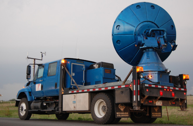
Tornado prediction remains frustratingly unreliable, with an average warning time of only 13 minutes and a false-alarm rate of around 75 percent. Applied to unfolding, real-time events, prediction seems too grandiose a term for what is often a sighting on radar or in the open fields and an exclamation of “Look, the storm has a hook!” Yet every spring and early summer, with about 1,000 tornadoes of varying intensities charging across America’s central states, residents of the area depend on these last-minute alerts to let them know when to seek shelter.

Until about 15 years ago, most attempts to measure the velocity of tornadoes and expose their structure—the basic data needed to improve prediction—came up empty. It was not for lack of trying. A small group of meteorologists headquartered in Norman, Oklahoma, had for decades employed ingenious means: instrumented probes, weather balloons, and small radar systems. Yet the success rate remained low. The complexity of studying tornadoes, even under the best of circumstances, is threefold. First, they are notoriously sudden and short-lived, so they must be addressed with speed. Second, they can be lethal, so approaching them and escaping from them must be done with caution. Third, without heavy equipment scientific missions repeatedly fail, but heavy equipment tends to conflict with problems one and two. Although the large-scale, stationary radar systems of the National Weather Service provide decent scans of supercells, the storms that harbor tornadoes, they are of limited scientific value for the study of smaller phenomena. Unless a vortex happens to rip right by a Nexrad (Next Generation Radar) post, the image is too distant and fuzzy to be of use. To get prime statistics and structural maps, you must be standing within a couple of miles of these winds, which are sometimes strong enough to hurl buildings.

Greensburg, Kansas, May 2007 | Image courtesy of Greg Henshall/FEMA

On that May evening when Umscheid was standing guard, two of the world’s most renowned tornado experts were separately traversing Kansas, hoping to get just such an intimate look. Lugging heavy radar and sensor equipment along the roadways, meteorologists Joshua Wurman and Howard Bluestein had been tracking the same volatile weather patterns all day. Former colleagues at the University of Oklahoma and both MIT graduates, the two men regularly crossed paths on the Great Plains and at conferences around the world. Acutely aware of each other’s advances, they built up storm-chasing fleets of ever-increasing capabilities.

Bluestein, the older of the two, is an avid photographer who has always been mesmerized by the uncanny beauty of tornadoes. These days the eclectic intellectual favors whatever works, be it collaborative numerical modeling or a hearty chase. Wurman is driven more by the taunt of the unknown and relishes extreme challenges. Spending most of the season as a nomad, doggedly pursuing storms with his team and sleeping wherever the weather takes him, he sees himself as the modern equivalent of the 15th-century explorers. “They were trying to find new continents. We are too, in our way,” he says.

A founder of the original group based in Norman, Bluestein prefers to restrict himself to brief sorties from this college town on days that show maximum potential. May 4, 2007, was such a day—on-screen at least. In reality, the macroscale data from the National Weather Service were not translating into dangerous circulations. Instead Bluestein and Wurman confronted a persistently blue sky until just before dusk. It looked as if neither scientist would get any closer to answering what they both regarded as the ultimate question, how is a tornado born?

The success of their mission depends, beyond the weather, on a technological brainchild of Wurman’s—the mobile radar truck. More than a decade ago he figured out how to chase and intercept nascent tornadoes with powerful, fast-scanning, full-size radar, a breakthrough that finally boosted the odds of catching these erratic phantoms. With the assistance of their Doppler on Wheels, or DOW, Wurman and his crew have amassed an unparalleled database: profiles of 141 tornadoes as of this season’s start. A DOW is a flatbed truck equipped with hydraulic feet to increase stability, a large radar dish that swivels when in operating mode, and an eight-foot antenna that sends out three-centimeter microwaves. When reflected back by rain, hail, airborne debris, or even insects, the waves create an image of storm activity and indicate wind velocity.

Every storm chase begins with an assessment of where supercells will burgeon, based on factors from the location of the so-called dry line—separating moist from arid air—to the speeds of upper-level winds. Supercells often appear in close proximity to one another and travel in groups. Because the cold air they emit interferes with the tornado genesis process, Wurman focuses on storms that are somewhat isolated from the advancing phalanx. When a supercell splits in two, as it often does, Wurman and Bluestein home in on the “right movers”—those that rotate counterclockwise, which tend to be more powerful. Yet there is still no guarantee that a tornado will form.

As the light faded that early day in May, Wurman’s forecasters were wondering if any clouds in driving range would even gather enough energy to achieve supercell status. Gradually his team edged northward, away from Greensburg toward a volatile on-screen patch that was turning up near the Nebraska state line. “I’m kind of worried that it’s a sucker play,” Wurman said, resigned to the idea that he was now playing a game of chance.

Bluestein, who earlier had been waylaid in southern Kansas for hours by a flat tire, characteristically decided to rely on visual cues. Peering to the southwest, he spotted a storm moving in. “It had a wall cloud, a flanking line, a back-sheared anvil, and an area of precip to the north,” he says. “It looked like a real supercell developing.” Bluestein and two graduate students had set up about six miles from Route 183, a north-south road bordered by grain fields and farmhouses. Drawing power from a portable battery, the X-band polarimetric Doppler radar mounted on the back of their truck scanned steadily. Now, to the amazement of this veteran storm chaser, the supercell began spawning tornadoes in sequence, a phenomenon known as cyclical tornadogenesis.

“It was beautiful,” Bluestein said months later, “just you and the storm. You could see the funnels coming down; they were illuminated by lightning.” Despite his battery’s being almost dead, he recorded “one of the most monstrous tornadoes I’ve ever seen on radar. It just kept getting bigger and bigger.”

At 9:36 p.m., as the mass of swirling air progressed northward at about 25 miles per hour, Bluestein and his team clambered into their truck to head home. Fifteen minutes later, one of the tornadoes they had intercepted rushed along Greensburg’s Main Street, swooping up the town and dropping it in mangled, splintered pieces. In its dying phase, the funnel most likely looped around and briefly retraced its path. Eleven people were killed, another 60 injured. It was the first-ever measured EF-5 tornado, the highest category on the Enhanced Fujita scale, and the most powerful since 1999, with an estimated peak wind speed of 205 miles per hour. The town of Greensburg was almost totally destroyed.

Carmen Renfrow was fortunate. She survived with her sister and pets and found her house almost intact. Not so John Haney. Down in the basement with his wife, he recalls, “You could hear every glass in that house break, and then you could hear the house leave. Then it got deathly quiet, and then we heard it again.” While Haney and his wife emerged uninjured, they later salvaged only enough belongings to fill the back of a pickup truck.

Within minutes, the radio announced news of the devastation. Driving back to Norman, Bluestein felt “kind of sick. You don’t like to hear that you’re out there doing something that’s fun and exciting and interesting—and that people are killed, that a town got wiped away.” Meanwhile Wurman, traveling near the Nebraska border, learned that Bluestein had intercepted the tornado of the decade. Intensely competitive and exhausted from his long day, he termed his miscalculation an “utter defeat.”

Long before meteorology became a national spectator sport, 12-year-old Joshua Wurman built a makeshift weather station in his backyard in a suburb of Philadelphia, erecting a wooden shelter to shield his instruments from the elements as they captured temperature and relative-humidity readings. In 1975, in high school, he spent $220, his savings from a summer job, on a recording thermometer and barometer set. “I was just sort of a nerdy protoscientist,” he recalls.

As a sophomore at MIT, Wurman decided his future would be in meteorology, only to find that there was no program for undergraduates. So he pieced together his own concentration under the heading “interdisciplinary science,” eventually working his way into the school’s Ph.D. program. Restless, he dropped out, only to beg his way back in three years later. It paid off, as did his postdoc position at the National Center for Atmospheric Research (NCAR) in Boulder, Colorado. By now he was an expert on radar. It would not be long before Wurman would shift his attention from bistatic radar networks to storm-chasing technologies, a field he would revolutionize.

When Wurman first conceived of the Doppler on Wheels in 1993, he encountered persistent resistance from his colleagues. “I was met with considerable skepticism,” he recalls. “They said, ‘You can’t do that. You can’t take a big radar out there; the things won’t work. You can’t scan while you’re driving. Your computers will crash.’ There were all kinds of reasons, technical and logistical, why people were cautious about doing it.” NCAR would not commit to the idea.

A former competitive debater with an obstinate streak, Wurman went ahead with his plan with the barest support from the University of Oklahoma in Norman, where he soon moved. Jim Wilson, a senior scientist at NCAR, says: “He was the kind of person who has an idea and doesn’t worry very much that there’s no money to buy this or that piece of equipment…. He’d beg, borrow, or steal—whatever. He didn’t let the administration get in the way.” Wurman proceeded to “lash together” a prototype radar truck in a mere four months, using castoffs from NCAR and “military surplus junk.” His total budget was $50,000. “People used to laugh at me because radars are supposed to be fancy, sophisticated systems with lots of good engineering, and there I was Velcroing and duct-taping things together,” he says.

The joking subsided in 1995 during the last days of a giant meteorological study called Vortex (Verification of the Origins of Rotation in Tornadoes Experiment), the largest tornado field project to date. Wurman—aided by his wife, Ling Chan, and another meteorologist —maneuvered the DOW, with its full-size radar equipment, close to the outer ring of a tornado rotating at about 170 miles per hour and captured three-dimensional images of these powerful winds. The details of the hidden architecture were breathtaking: an 1,800-foot-high ring of debris, a central eye with a downdraft within it, and evidence of an orderly array of wind speeds across the funnel.

“There was a huge blind area, and we erased that blind area instantly,” Wurman says.

Wilson still marvels at what Wurman achieved. “During Vortex, NCAR had a radar on an airplane called Eldora, and that got some really great data too,” he says. “If you take the DOW radars and airborne radar, boy, a lot of what we know about tornadoes today is pretty much from the data they collected.”

Airborne radar costs about a million dollars to operate per season, so it is rarely employed. Wurman’s mobile-radar trucks have been the single largest source of data over the past decade, including the remarkable capture in 1999 of images of the most powerful wind ever logged: 301 miles per hour.

Four years later, emboldened by his success, Wurman quit a tenured position in Norman and struck out on his own, establishing the Center for Severe Weather Research in Boulder. Unaffiliated, he risked his academic colleagues’ disdain by forming a complex alliance with television’s Discovery Channel to keep his fleet rolling.

Fathoming how monstrous concentrations of wind energy are created and then being able to forecast them are among the biggest, most urgent challenges in disaster science. Meteorologists continually dissect field observations and run computer simulations to isolate the critical variables that contribute to the moment of a tornado’s birth.

The majority of tornadoes take shape within supercells. Unlike hurricanes, which develop over bodies of water, tornadoes tend to incubate over land (water spouts being the exception). The most dangerous kind breed within storms that are themselves intimidating, often delivering hail the size of golf balls, vicious gusts of wind, and rain capable of flooding roads instantly. To qualify as supercells, these storms, which frequently extend to 50,000 feet in altitude, must contain a rotating wind called a mesocyclone. In the 1970s and ’80s, meteorologists identified the three basic ingredients that combine to make a supercell: a source of energy, a source of rotation, and a cap.

“It’s during the transition season of spring that conditions are most often realized,” Wurman says. “That’s when we still have strong waves in the jet stream from the winter, but we’re also beginning to get warm, soupy air up from the tropics, from the Gulf of Mexico.” The rush of the colder, midlatitude westerly air above the southeasterly surface flow creates an environment laden with energy. Differences in direction and speed of airflow provide a source of rotation. Imagine a giant horizontally oriented pinwheel, Wurman says. At the top of the wheel, air is pushing from one side; at the bottom, air is pushing from the opposite side. Together the forces make the pinwheel spin.

The final component in the storm recipe is the cap, a plug of warm air that typically hovers around 10,000 feet up. During morning and midday hours, it traps heat. “The energy is stored up and stored up and stored up during the day as the surface heats, until finally there is enough hot air that it breaks upward through this cap and is released fairly quickly,” Wurman says. At this point, an ordinary thunderstorm develops. But in the already volatile atmosphere, the storm’s updrafts and downdrafts—internal winds that rise and fall—may tilt and stretch the rotation from horizontal to vertical. If that happens, the axle of the pinwheel turns upright, and a potentially dangerous mesocyclone comes into being. The benign storm has graduated into a supercell, its whirling center a possible hatchery for tornadoes.

Yet something big is missing from this picture. “Most severe rotating thunderstorms don’t make tornadoes,” Wurman explains. “Only between one-tenth and one-third of them do. And we don’t really know the differences between the ones that do and don’t, and that’s why the tornado warnings that go out have such a huge false-alarm rate,” he says. “In addition, we don’t know when, during the lifetime of one of these storms, it is going to make a tornado.”

Only by examining a large number of tornado intercepts can Wurman learn the average dimensions, rotational velocity, speed of progression, life span, and more. A doctoral student named Curtis Alexander, whom Wurman is advising, has made a start. He has almost completed a climatological study of these winds based on most of Wurman’s 141 data sets.

Some of Alexander’s findings confound the experts. Take the ferocity of the winds. It had always been assumed that about 2 percent of tornadoes fall into the violent EF-4 and EF-5 categories on the Enhanced Fujita scale, which estimates wind force primarily on the evidence of damage to man-made structures. Alexander’s preliminary results suggest that these “town killers” account for a much larger portion—15 times larger, about 30 percent of the total. This would indicate that at least 300 potentially devastating tornadoes churn through the United States every year, nearly all unrecorded as they sweep through remote countryside.

“We would have thought that most were EF-0s, weak, and that you get fewer and fewer as they get stronger and stronger,” Wurman says. “But that’s not the case. It turns out that there are not many weak ones, mostly moderate ones, and a surprising number of violent ones.” At the moment, there is no explanation for this observation.

The amount we still do not know about tornadoes amazes Wurman, who recalls his 2005 encounter with an advancing supercell with two tornadoes in its midst. One was “single vortex, fairly smallish”; the other was “this big dust roll with multiple vortices.” He was stupefied that such different structures could arise under very similar conditions. “If it was something to do with the relative humidity or the temperature or the winds that day, then how did two different outcomes happen?” he asks. “I guess I was just in awe of my ignorance.”

Last year’s death toll of 125 from tornadoes in this country was the highest in a decade and the second-highest in more than 30 years. The reasons remain obscure. So it is apt that this May some 80 atmospheric scientists (including Bluestein and Wurman) will gather in Norman to engage in a five-week, military-style campaign of surround-and-conquer, adopting Wurman’s nomadic style and throwing everything they’ve got at solving the problem of tornado prediction.

“It is by far the most ambitious, largest tornado study that has ever happened,” Wurman says. “There is no comparison with any previous tornado project, really.” Named Vortex2, it is funded by the National Science Foundation and the National Oceanic and Atmospheric Administration with a budget of about $7 million, and it will extend over two spring seasons. Both Bluestein and Wurman are on the project’s eight-member steering committee.

The scale and logistics of Vortex2 are enormous. Some 30 vehicles will participate, including 10 mobile radar trucks, four weather-balloon launchers, and two vehicles bearing a total of four disdrometers (to measure the size distribution of rain or hail). In addition, 10 instrumented vehicles will form a mobile mesonet—a temporary automated network of weather stations. Fast-working crews will deploy and retrieve 36 probes, including two dozen Stick-Nets, tripod-mounted instruments, in and around tornadoes. Outfitted with anemometers, the probes will log wind speed and other information at ground level, a zone overshot by radar.

Erik Rasmussen, a prominent meteorologist who led the previous Vortex project, will use unmanned aircraft to record temperature and relative humidity at various altitudes. Other researchers will shoot storm videos for later analysis. Should there be direct tornado hits on towns, damage-survey teams will break off from the group to collect data on the impacted structures.

Never having collaborated before, Bluestein and Wurman will arrive at Vortex2 knowing that nothing short of a huge team effort will yield detailed portraits of tornadoes, their parent supercells, and nesting mesocyclones —the data needed to unravel the mystery that has surrounded tornadoes. “It’s more fun being out on your own than being told what to do,” Bluestein says. Still, he acknowledges, “in order to make what Josh and I have been doing more valuable, you must have a more complete time record of the entire storm.”

Adapting technologies invented for military defense, Bluestein and Wurman are now experimenting with phased array and rapid scan, or multibeam, radars, able to view a complete storm in 10 seconds. Once their analysis of the data from Vortex2 is complete, Wurman is optimistic that meteorologists will finally know why “some storms make big tornadoes versus small tornadoes, what causes a tornado to strengthen, what causes it to die.” The next time, he hopes, people on the ground will not have to wait and wonder what is about to hit, as they did in Greensburg. “We need to be able to tell forecasters, we need to be able to tell computer modelers what we’ve learned,” he says. A reliable one-hour tornado warning for families in the Midwest, Wurman says, would be “a great success.”

1 free article left
Want More? Get unlimited access for as low as $1.99/month

Already a subscriber?

Register or Log In

1 free articleSubscribe
Discover Magazine Logo
Want more?

Keep reading for as low as $1.99!

Subscribe

Already a subscriber?

Register or Log In

More From Discover
Recommendations From Our Store
Shop Now
Stay Curious
Join
Our List

Sign up for our weekly science updates.

 
Subscribe
To The Magazine

Save up to 40% off the cover price when you subscribe to Discover magazine.

Copyright © 2024 Kalmbach Media Co.