We have completed maintenance on DiscoverMagazine.com and action may be required on your account. Learn More

Once We Wire It Up, What Will the Ocean Tell Us?

A network of sensors and robots, linked 
by fiber-optic cables, 
will soon start 
monitoring the vast aquatic frontier, revealing what's going on in one of the most mysterious parts of our world.


By Jennifer Barone
Jun 25, 2012 5:00 AMNov 12, 2019 5:15 AM
telepresence1.jpg
Scientific concept by John Delaney/University of Washington; graphic design by Mark Stoermer/Center for Environmental Visualization/University of Washington

Newsletter

Sign up for our email newsletter for the latest science news
 

John Delaney stepped out onto the deck of the Thomas G. Thompson shortly before dawn one day last August and paused to look at Puget Sound, an evergreen-lined inlet near Seattle that meanders out to the Pacific. As the ship made its way toward the ocean, he glanced at the white peaks of the Olympic Mountains with a knowing eye. “Those rocks were created on the seafloor, distilled from molten material from the mantle,” he said. “They were part of a tectonic plate that got jammed up onto the continent.” He watched as the glassy, protected waters of the sound gave way to ripples and sparkling wavelets, hints of the interplay between wind and sea and the currents that course around the globe. He registered the sun on the water and pondered the patterns of energy fueling the blooms of tiny marine plants that nourish an ever-expanding web of life. Every facet of the ocean conjured another, weaving a tapestry so complex he knew he would be studying it for the rest of his life.

To unravel that intricate tangle of relationships, Delaney has envisioned a web of his own: a sprawling undersea network off the coast of Washington and Oregon whose strands of power lines and fiber-optic cables would stretch hundreds of miles along the seafloor, connecting researchers with the ocean like never before. On this expedition, Delaney was setting out to test key components of the system for the first time. And this deep-sea Internet is just one arm of the enormous $770 million Ocean Observatories Initiative (OOI) now under way.

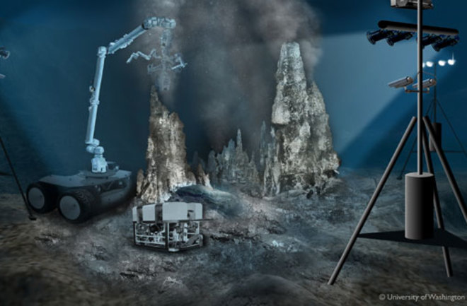
In addition to Delaney’s cabled network, the program includes five other sites scattered from the tip of South America to the waters near Greenland, where swarms of instruments will shuttle up and down cables and fly through the water on robots controlled from shore. For decades, sensors will gather data on water chemistry, currents, photosynthesis, animal activity, and seafloor eruptions and earthquakes. When the work is complete, researchers will piece together a systemwide view of the marine environments that cover more than two-thirds of the planet, bringing into focus the interrelationships among the seafloor, the water, and the atmosphere. Does ocean chemistry alter climate? Does undersea geology impact fish populations? Will the web of marine life deliver new energy sources from the sea?

“It’s pioneering a way of investigating the ocean,” says Timothy Killeen, assistant director for geosciences at the National Science Foundation (NSF). “It will lead to areas of research that we can’t even imagine today.” For Delaney, that vote of confidence represents both opportunity and pressure. “If this doesn’t succeed,” he says, “the next time ocean scientists want to tackle something big, we won’t get the chance.”

Like so many oversize ambitions, the scheme to build a seafloor Internet took shape in a bar. In 1991 Delaney, an oceanographer at the University of Washington, went out for a drink one evening with Alan Chave, an ocean engineer and marine geophysicist based at the Woods Hole Oceanographic Institution. The two were collaborating on a study of mid-ocean ridges, chains of volcanoes and hydrothermal vents that snake around the planet like the seams on a baseball.

Delaney was griping to Chave that the occasional dive in a submersible just wasn’t cutting it for learning how ridge systems worked. Every time he returned to a place, it looked completely different: New lava flows had appeared, vent structures had grown or collapsed, and animal communities had changed, but it was impossible to tell when, how, or why. “It’s so frustrating being down there for a few hours at a time,” Delaney complained over his drink. “We never have long enough to understand what’s going on.”

Chave had recently worked at Bell Laboratories, coordinating a project to reuse an old AT&T seafloor telephone cable to transmit undersea earthquake data to researchers onshore in Japan. “Maybe we could use a cable to collect data at a ridge,” he suggested. Outfitted with scientific instruments and a video camera, a communications cable would allow Delaney and Chave to watch eruptions on the bottom in real time while safely ensconced in their offices.

The idea seemed a bit outlandish, but over the next several years, the two researchers kept pressing the notion at conferences and meetings, and other scientists chimed in enthusiastically with ideas of their own. On a visit to the Institute of Ocean Sciences in British Columbia, Delaney mentioned undersea networks to physical oceanographer Rick Thomson, who proposed adding acoustic sensors to measure the movement of schools of fish. Biological oceanographer Kendra Daly of the University of South Florida heard a talk by Delaney and excitedly told him that his concept would finally allow researchers to study the ephemeral changes that were so difficult to capture from a ship: a storm churning up the waters below, for instance, or the springtime bloom of microscopic marine plants.

Encouraged by the feedback, Delaney and Chave, along with about 65 other scientists, began to hammer out a proposal in 1998. They would hire industry subcontractors to lay a fiber-optic cable on the ocean bottom. Dotted along its path would be nodes, big boxes of electronics that would serve both as data routers and as power outlets for undersea instruments. A fleet of remote-controlled robotic vehicles would target transient events—for example, gathering gases and microbes released during a seafloor eruption.

Image courtesy of OOI Regional Scale Nodes program and Center for Environmental Visualization, University of Washington.

As for where to put the network, Delaney and his collaborators suggested the Juan de Fuca tectonic plate, a roughly triangular piece of crust that juts out into the Pacific from the northwest coast. There they would be able to observe several important processes—the formation of new seafloor, volcanic eruptions, the movement of nutrients from deep to shallow waters, and earthquakes.

Delaney and his partners targeted two sites on the plate as promising places to install their first instruments. One was Hydrate Ridge, selected for its large methane deposits and the unusual chemosynthetic organisms that thrive on top of them. Methane is a potent greenhouse gas, so scientists are interested in how it might be released from the ocean bottom. It is also the main component of natural gas; the Department of Energy is investigating whether the fuel can be mined from humongous deposits under the seafloor.

The second spot was Axial Seamount, an active underwater volcano, along with its associated hydrothermal vents, where the team could study the transfer of minerals from beneath the seafloor into the water and access hardy microbes that thrive in the vent fluids, which can reach 250 degrees Fahrenheit. During eruptions, they might be able to collect even stranger microorganisms that live in the scorching depths of Earth’s crust.

In 2000 Delaney’s group submitted the plan to the National Oceanographic Partnership Program, a collaboration of federal agencies involved in ocean research. The idea had the backing of Mike Purdy, then director of ocean sciences at NSF. Purdy had seen firsthand the limitations of existing tools. He knew that ships were great at collecting data from different locations, but when they returned to the same spots a year later, conditions were often wildly altered.

“We need a new approach to understand changes over time,” Purdy said. Delaney’s cabled observatory addressed that. And bringing power lines from shore would solve the problem of seafloor sensors whose batteries went dead, something Purdy had experienced himself.

Smaller projects already under way were proving that the deep-sea network concept could work. Scientists at the Monterey Bay Aquarium Research Institute in California had laid a 32-mile cable from shore to a site off the coast, testing power supplies, data cables, and instruments. A team at the University of Victoria in British Columbia had developed a cabled installation to study the physical and chemical properties of the local ocean.

Delaney’s proposal would dwarf those projects. Purdy hoped to fund the new ocean observatory through an account that NSF maintains for game-changing scientific infrastructure. But to win approval, the program would have to cover more than just the Pacific Northwest coast. Over nearly a decade, Purdy and his successor, Larry Clark, gathered recommendations from hundreds of researchers on what an ocean observing system should do and which sites would be best to add.

In 2009 the agency settled on a design that included not only Delaney’s cabled network at Juan de Fuca but also a wireless, satellite-linked network off Cape Cod to study the transition between shallow continental-shelf waters and the deep ocean, as well as sensor-packed moorings at four sites in high-latitude waters that are rich with aquatic life.

That fall NSF agreed to provide three-quarters of a billion dollars for construction and initial operation of the Ocean Observatories Initiative—a staggering sum in the modest-budget world of ocean exploration. By November Dela­ney had contracted marine operations company L-3 MariPro to build the backbone of his deep-sea network, including the seven nodes that will power instruments and transmit data through the system.

Finally, in the late spring of last year, the cable-laying vessel Dependable began stringing 560 miles of fiber-optic line from Pacific City, Oregon, to Hydrate Ridge and Axial Seamount. A few months later, with cable installation still in progress, Dela­ney and his team set out from Seattle aboard the Thompson to test a node in the water.

Trip to the Ocean Floor

The Thompson winds through Puget Sound and then out into the Strait of Juan de Fuca, stopping in Victoria to pick up Ropos, a remotely operated vehicle (ROV) whose motions can be controlled from the ship. The plan is for Ropos to carry a node—a 3,000-pound, yellow and orange watertight box about the size of a refrigerator—to the shallow bottom of the strait to test the plugs and connections that will link it to the cable and to scientific instruments.

The morning is chilly, with fog as impenetrable as the dark waters below. Ropos comes to life on the port-side deck as the vehicle’s engineers run their pre-dive check. The robot’s camera scans up and down, then side to side. One by one its lights flicker on and off at the command of technicians in the control room.

Crew members lower a titanium cage, which will serve as a protective frame for the node, down to the seafloor. Next Ropos must go down to unhook the wire used to lower the frame and open its doors so that the node can be placed inside. A crane lifts the robot from its cradle. With camera lenses for eyes and mechanical arms folded against its yellow and black body, it looks like a giant insect poised above the water. The crane drops Ropos in. Its lights pop on and diving thrusters kick into gear. Then it disappears into the gray, trailing the umbilical tether that allows it to communicate with the ship.

About 15 scientists and engineers crowd into the dark control room to watch the ROV’s video feed. Pilot Reuben Mills navigates Ropos to the frame and begins unscrewing shackles connecting it to the wire, clearing the way for the node. No one speaks. The assembled researchers bite their lips, following Ropos’s smallest movements. Its two-fingered mechanical pincer grabs the pin of a shackle in an attempt to undo it, then slips off.

Jonathan Lee, another Ropos pilot, explains that if a sensitive manipulation fails on the first try, the pilot can end up in a “death spiral,” overcompensating on every movement due to nerves and sending Ropos’s arms in circles around their target. Mills keeps his cool, though, and after a few hours of painstaking work, the frame is ready. Ropos collects the node from the deck and heads back down to insert it into the frame, this time with Lee piloting.

Although the vehicle is returning to the spot it left earlier in the day, strong tidal currents are flowing now, and even with his thrusters at full power, Lee struggles to hold the ROV in place. Delaney unhappily eyes the blizzard of plankton and detritus zooming by on the video feed. “It looks like warp 6 down there,” he says. “This could be a serious problem.”

On the bottom, visibility fades to a few feet; everything beyond is a swirl of sediment. After a grueling two-hour battle against the current, Ropos reaches the frame. Unable to see clearly, Lee tries to maneuver the node into its slot by feel, without success. The group opts to wait for conditions to improve, but three hours later, the situation is not much better. Ropos operations manager Keith Shepherd slides into the pilot seat for one final attempt and somehow manages to drive the node into its frame. Deciding not to push its luck, the team abandons the remaining tests and hauls its equipment out of the turbulent water.

And that is just one node. Installing seven of them, and connecting them all to the main cable, will be a major undertaking. Delaney estimates that it will take two months at sea to complete the job.

Two days later, the Thompson heads over to Hydrate Ridge, 60 miles west of the Oregon coast. There the team plans to test a current meter, which measures water flow. Nearly half a mile down, Ropos’s lights pierce the darkness of the bottom, an uneven terrain dotted with rocky outcrops and what look like patches of white snow—sulfur-eating bacteria that form mats on the sediment. Unlike the test site, Hydrate Ridge is too deep to be disturbed by strong currents. Crabs amble slowly across. Purplish hagfish writhe in and out of view, probably searching for a sunken animal corpse to eat.

“So gross,” Shepherd shudders. “Don’t get buried at sea.” Once the seafloor network is operational, these rare glimpses of life on the bottom will be available live on the web.

Ropos drops off the current meter and resurfaces for a second attempt at the node tests that were stymied by the current closer to shore. This time, everything goes flawlessly. The pilots drop the node into its frame and practice plugging and unplugging connectors that will power extension cords and instruments.

The team’s next goal is to retrieve an empty instrument frame that engineers put down the previous year to see how it would hold up in seawater—a preview of what the observatory’s sensors will endure once they are installed for real. When the frame emerges from the water, strands of algae hang from its surfaces like gray-green hair, but otherwise it is in good condition, with almost no corrosion. Since the engineers plan to bring many instruments up for maintenance once a year, it seems that at Hydrate Ridge their network should be able to operate through its planned life span of 25 to 30 years.

Over the Volcano

Life is rougher at Axial Seamount, where Delaney is headed a week later. The hyperactive undersea volcano continually vents superhot fluids, and magma eruptions occur every 10 to 15 years. Undaunted, Delaney plans to wire that site too, hoping to show how vented minerals accumulate on the seafloor and diffuse into the water above. The vents host evolutionarily ancient lineages of microorganisms and may have been a cradle supporting early life on the planet.

As a home for sensitive scientific equipment, though, Axial Seamount carries big risks. “It’s pretty mind-boggling,” says chief systems engineer Chuck McGuire. “We’re building this thing worth hundreds of millions of dollars, and we’re going to deploy a big part of it—on purpose—in what may be the harshest place on the face of the planet, on top of a volcano.”

At a meeting where Delaney and co-chief scientist Deborah Kelley review plans for the site, one researcher asks whether they should rethink the observatory layout in the wake of a recent eruption. “Look,” Delaney replies, “if you’re going to study an active volcano, you’ve got to be prepared to lose a few things. We’re trying to learn how the lifeblood of the planet works. That means we have to be there.”

Instead of trying to protect all of their gear, Delaney says, they will try to identify the safest spots for the nodes, which provide vital power and communications, and then do their best to organize the sensing instruments so that no single eruption can take out everything. Sensors at the volcano and back at Hydrate Ridge will include seismometers, high-def video cameras, temperature and pH sensors, and current meters. The network will also test cutting-edge tools like an underwater mass spectrometer—which can determine the composition of a substance on the spot—and a microbial sampler to sequence DNA on site.

At Axial, the team on the Thompson sends Ropos to locate the fiber-optic cable, laid down just a few weeks earlier. Ropos traces the cable’s route on the seafloor as Delaney and the others watch the video feed, rotating in shifts, to make sure the cable looks safe, with no sections dangling from rocks or rubbing against rough surfaces. Everything looks fine—except for one segment, which is draped over a previously unknown hydrothermal system. The site is like a hidden city on the seafloor, with sulfide vents towering 120 feet tall, some emitting hot black fluids.

Contractors will replace this portion of the cable this summer, before Delaney’s team returns to install all seven nodes, hooking them up to the master cable. Then in 2013 they will plug in their instruments using more than 40 miles of extension cords. By 2014, sensor-carrying robots that climb up and down wires—still under construction—will arrive, completing the initial installation. The other five OOI sites should be up and running by then as well.

To Delaney, that is not an end point; it is just the beginning. “We’re pushing the envelope with this project,” he says, “but we’ll be a test bed for future observatories around the world.” More than 95 percent of the ocean remains unexplored, and several other countries are already working on parallel programs (like this [pdf]). Last summer Japan completed a cabled seafloor network called DONET, focused on offshore earthquakes and tsunamis. A cable links 20 sites, each of which hosts seismometers along with pressure sensors that can pick up changes in the shape of the seafloor. Project leader Yoshiyuki Kaneda hopes that such data will provide clues about the buildup of pressure in the crust that leads to large earthquakes.

Other projects share the OOI’s broader approach. The European Multidisciplinary Seafloor Observatory program, or EMSO, will install instruments at 12 locations around the continent, from the Arctic to the Black Sea. Like OOI, EMSO will collect a wide range of data, integrating geologic, biological, and climate-change observations. The initial phase of construction will begin at seven sites this year and is projected to be completed by 2016.

Delaney views these projects with a deep sense of urgency. Ocean life does not exist separately from land life any more than the Olympic Mountains are separate from the undersea volcanoes that spawned them. More than half the oxygen we breathe comes from the ocean, much of it from aquatic ecosystems that scientists have barely begun to study.

“No one would ever allow a spacecraft to take off if its engineers didn’t have a thorough understanding of its life-support system,” he says. “We know so little about that system here on Earth, and the ocean is a huge part of it. We have to learn to identify when it might be approaching tipping points, so that we can respond and manage them. We can’t do that yet. We’re not wise enough. But this is a step in the right direction.”

Jennifer Barone is senior associate editor at DISCOVER.

1 free article left
Want More? Get unlimited access for as low as $1.99/month

Already a subscriber?

Register or Log In

1 free articleSubscribe
Discover Magazine Logo
Want more?

Keep reading for as low as $1.99!

Subscribe

Already a subscriber?

Register or Log In

More From Discover
Recommendations From Our Store
Shop Now
Stay Curious
Join
Our List

Sign up for our weekly science updates.

 
Subscribe
To The Magazine

Save up to 40% off the cover price when you subscribe to Discover magazine.

Copyright © 2024 Kalmbach Media Co.