These days, we're accustomed to seeing very high resolution satellite images revealing the horrifying impact of extreme weather. Below, I offer a particularly dramatic example: before and after images of the destruction wrought by a tornado — one of at least 20 in an outbreak across the South — that ravaged Rolling Fork, Mississippi on March 24, 2023.
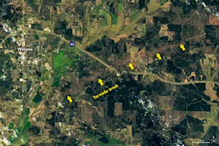
But I was struck even more by the broader perspective seen in the image above, published by NASA. Instead of a relatively close up view of homes and businesses ripped to shreds, the Landsat 9 image reveals the scar gouged out of the landscape by one of the March 24 tornadoes. The tornado track seen in the image is a little more than eight miles long.
Here's an even broader view showing the tornado's entire 29-mile track:
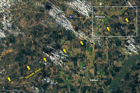
A broader view of the area around Winona, Mississippi, acquired on March 24, 2023 by the Landsat 9 satellite. Nearly all of the 29-mile scar track of the tornado is visible as a brownish scar gouged into the landscape. (The rectangle at upper right shows the portion of the scene visible in the image at the top of the article. Credit: NASA Earth Observatory)
NASA Earth Observatory
It first touched down in a wooded area near Black Hawk, Mississippi, at the lower left corner of the image. With winds reaching 155 miles per hour, it snapped and uprooted trees, flipped vehicles, and destroyed homes and other structures. Tragically, three people were killed.
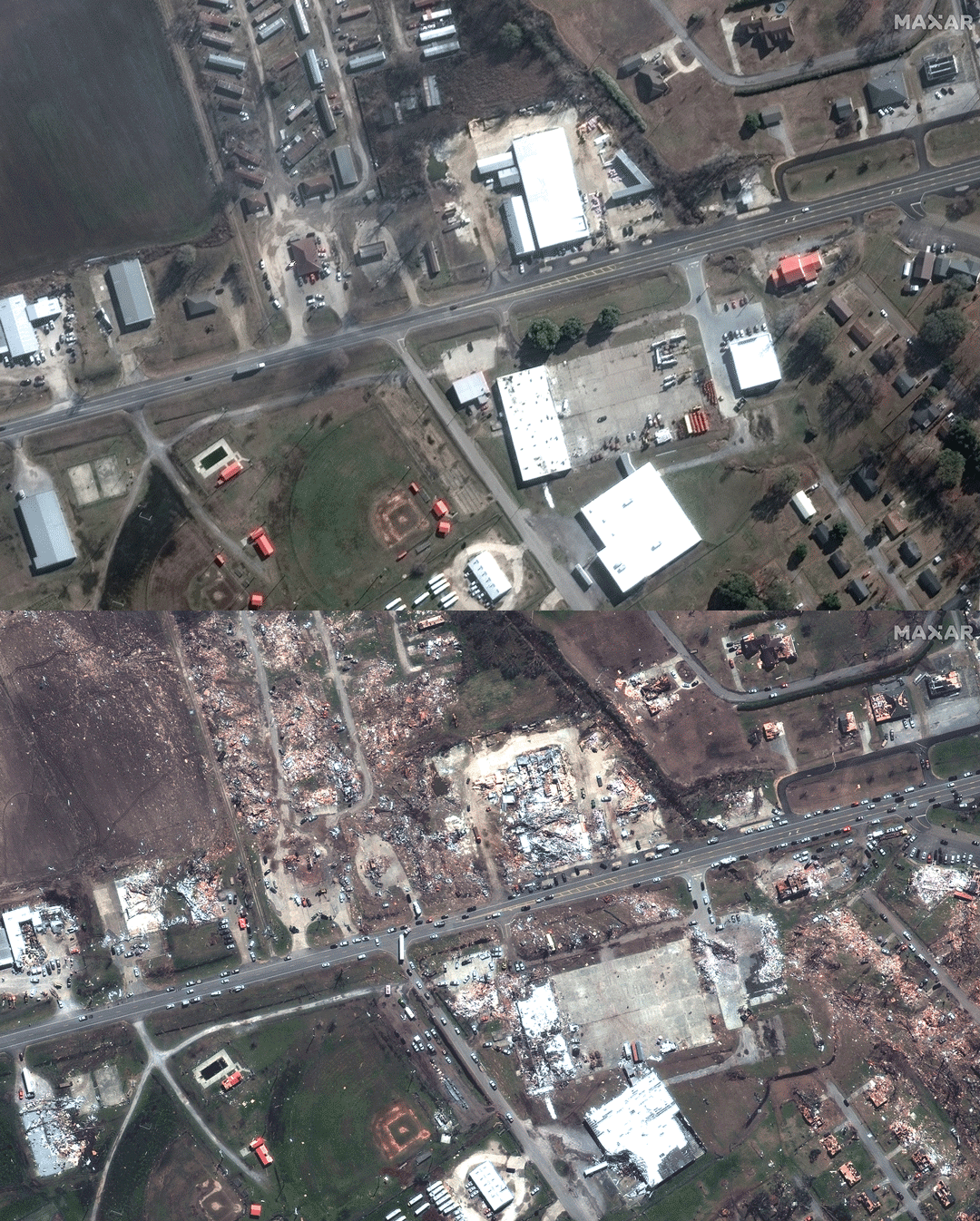
Before and after satellite images reveal the extent of destruction to homes and businesses wrought by a tornado that roared through Rolling Fork, Mississippi on March 24, 2023. Before: Dec 27, 2022. After: Mar 26, 2023. (Credit: Maxar Technologies via Twitter)
Maxar Technologies via Twitter
An even stronger tornado touched down about 70 miles to the southwest. During it's nearly 60-mile journey lasting more than an hour, this twister's winds reached at least 170 miles per hour.
Roaring through Rolling Fork, the tornado left much of the tiny town in ruins — as the high-resolution before-and-after satellite images above show so tragically.
At least 21 people in Mississippi, and one in Alabama, lost their lives as powerful thunderstorms spawned the tornado outbreak across a broad swath of the Deep South. In western Mississippi's Sharkey County alone, 13 people out of a population of just 3,700, perished in the storms.


