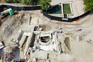
Five circular depressions in the desert north of Bluff, Utah, have long been a source of tantalizing frustration to archaeologists. For the past two decades, the prevailing theory was that the desert hollows conceal five great kivas—subterranean circular masonry structures approximately 40 feet in diameter where ancient Pueblo people gathered more than 700 years ago to perform religious rituals. Although researchers have longed to excavate the site, called Comb Wash, the cost—roughly $1 million—and the time—about five years—have been prohibitive, not to mention the opposition by Native Americans to disturbing sacred grounds.
Then along came a pair of archaeologists from the University of Denver with a noninvasive, nondestructive technology to topple conventional thinking. Using ground-penetrating radar and software originally written for scans of the human brain, archaeology graduate student Tiffany Osburn and ground-penetrating-radar expert Larry Conyers have visualized the subterranean structures buried beneath the sediment. Rather than revealing great kivas ...


