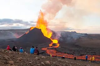
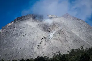
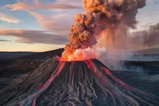
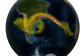
From eruptions in Iceland to Krakatau in Indonesia, there have been many volcanic eruptions making headlines in 2023. And we saw plenty of eruptions in 2022. From the Lascar volcano in Chile, Mount Semeru in Indonesia and Hunga Tonga in the South Pacific to the quiet eruptions of Mauna Loa, 2022 was quite the year for volcanoes.
But, how can scientists predict volcanic eruptions before they erupt?
While volcanic eruptions like Mauna Loa are relatively calm and cause minimal damage, eruptions like Mount Semeru and Hunga Tonga can force people to evacuate their homes, cause extensive damage to property and the ecosystem, and even death. Though there is no telling how much damage a volcanic eruption can have, there are ways to predict when eruptions may occur.
What Causes a Volcano to Erupt?
A volcano erupts when magma rises to the surface due to lower density and pressure, aided by the formation of gas bubbles. The type and severity of an eruption depend on various geological factors, including the composition of the magma and the Earth's tectonic activity. Here's a breakdown of what causes a volcano to erupt:
Magma Formation
Magma is formed when the Earth's mantle (the layer beneath the crust) melts. This melting can be caused by various factors, such as the movement of tectonic plates, the presence of hot spots, or the addition of water and other volatile substances that lower the melting point of rocks.
Pressure Buildup
As magma forms, it starts to rise towards the Earth's surface because it is less dense than the surrounding solid rock. As it rises, the pressure decreases, allowing gasses dissolved in the magma (like water vapor, carbon dioxide, and sulfur dioxide) to form bubbles. This process is similar to the bubbles that form when you open a carbonated drink.
Eruption Trigger
The increasing pressure from these gas bubbles pushes the magma through the cracks and fissures in the Earth's crust. When the pressure becomes too great for the crust to contain, it causes an eruption.
Types of Eruptions
The nature of the eruption can vary greatly depending on factors such as the viscosity of the magma (how thick or fluid it is), the amount and type of gases it contains, and the structure of the volcano itself. Magma with higher viscosity (like that found in stratovolcanoes) tends to produce more explosive eruptions, whereas more fluid magma (like that found in shield volcanoes) tends to create gentler, flowing lava eruptions.
Tectonic Activity
In regions where tectonic plates diverge or converge, magma can more easily rise to the surface, leading to frequent volcanic activity. For example, the Ring of Fire around the Pacific Ocean is a result of plate tectonics and is home to many of the world's volcanoes.
Read More: The Origins of Plate Tectonics May Stretch Further Back in Earth's History
What Happens When a Volcano Erupts?
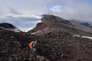
Some volcanoes, like Mauna Loa, stay dormant for decades. While others, like Italy’s Stromboli Volcano, erupts almost daily. Regardless, volcanologists — scientists who study volcanoes — monitor these volcanoes, among most other active volcanoes, every day. According to the U.S. Geological Survey (USGS), these signs include:
An increase in earthquake frequency and intensity (around the volcano).
Changes to the ground surface like swelling.
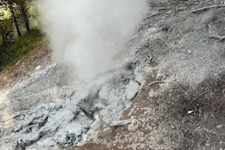
Noticeable steam activity.
New or enlarged areas of hot ground.
Changes to heat flow.
Changes in the composition or abundance of fumarolic gasses — gasses emitted from the volcano.
While these signs are indicators of an eruption, according to the USGS, they cannot tell volcanologists the type or scale of the eruption. These signs may continue for weeks, months and even years before any volcanic activity. Sometimes, there isn’t even an eruption, and the volcano goes back to being silent. So how do we know if a volcano is actually going to erupt?
Read More: 5 of the Most Explosive Volcanic Eruptions
Can Volcanic Eruptions Be Predicted?
Yes, volcano eruptions can be predicted. According to the USGS, volcanologists use various tools to monitor volcanic activity. These tools are typically easy to install and maintain and usually last for years.
Seismic Stations
One tool scientists use is a seismic station — usually fitted with a GPS — to monitor earthquake activity around a volcano. These stations run on solar power and transmit data via low-power radios in real time.
Tiltmeters
When volcanologists notice changes in the volcano’s surface, they may use a device called a tiltmeter to measure the change in a volcano’s slope. They can detect a difference of one part per million.
Spectrometers
To indicate the changes in gasses emitted from the volcano, volcanologists use a device called a spectrometer — which analyzes the light coming through the volcanic plume. Each gas has its own light signature; luckily, this tool can be used safely.
Thermal Images
Volcanologists also use thermal images from satellites and aircraft to identify new, hotter lava flows. Aircraft and satellites are also used for radar mapping, which helps create a three-dimensional map of the volcano’s surface, possibly predicting which way lava may flow.
Some of these tools were used to predict the 1991 eruption of Mount Pinatubo in the Philippines. According to the USGS, the joint effort of the Philippine Institute of Volcanology and Seismology (PHIVOLCS) and the USGS saved over 5,000 lives and $250 million in property by predicting the eruption. Local residents, along with the U.S. Clark Air Force Base, were able to evacuate before the level six eruption.
Though volcanologists have the tools to monitor volcanoes, they can still be unpredictable. Some may show signs of activity and never erupt, while some may seem to erupt out of nowhere. As technology develops, it will be interesting to see just how precise volcanologists could become.
Read More: 5 Things You Might Not Know About Volcanoes
How to Survive a Volcano Eruption
Volcanic eruptions can be both awe-inspiring and devastating. Understanding what causes these natural events is crucial, but it's equally important to know how to protect yourself if one occurs. Whether you're near a volcano like Mauna Loa, which poses minimal threat, or facing a more volatile eruption like Mount Semeru or Hunga Tonga, being prepared is key. Here’s what Ready.gov says to do to survive a volcano.
Preparing for an Eruption
Stay informed: Regularly check updates from local authorities and geological services. Knowledge of a volcano's behavior can provide crucial early warnings.
Evacuation plans: Familiarize yourself with local evacuation routes and plans. If an evacuation order is issued, follow it immediately and calmly.
During an Eruption
Indoor safety: If you're indoors, close all windows and doors to keep ash out. Stay under sturdy furniture if there's falling debris.
Outdoor precautions: If caught outdoors, use masks to avoid inhaling ash. Protect your head and seek shelter as soon as possible.
Avoid river valleys: Stay clear of river valleys and low-lying areas where lava or mudflows might occur.
Driving: If you must drive, do so with caution. Ash can reduce visibility and make roads slippery.
Post-Eruption
Stay away from affected areas: Even after an eruption seems to have ended, avoid the area until authorities declare it safe.
Health check: Be aware of respiratory issues caused by ash, and seek medical attention if necessary.
Property maintenance: Carefully clean up ash from your property, being mindful of roof weight limits and potential water contamination.
Read More: Did Massive Volcanic Eruptions Drive Dinosaurs to Become Extinct?
Frequently Asked Questions About Volcanoes
What Is a Volcano?
A volcano is a geological structure formed when magma (molten rock) from within the Earth's interior reaches the surface. It typically features a mountain or hill with a crater or vent. Volcanoes are found both on land and under oceans and are often located along tectonic plate boundaries.
How Do Volcanoes Erupt?
Volcanic eruptions occur when magma rises to the Earth's surface, driven by the lower density and pressure of the magma compared to the surrounding solid rock. As the magma ascends, gasses within it form bubbles, increasing pressure. When this pressure exceeds the strength of the Earth's crust, it results in an eruption. The type and intensity of an eruption depend on factors like magma viscosity, gas content, and the volcano's geological structure.
How Often Do Volcanoes Erupt?
The frequency of volcanic eruptions varies widely among different volcanoes. Some volcanoes, like Hawaii's Kilauea, are almost continuously active, while others may erupt infrequently, remaining dormant for hundreds or even thousands of years. The eruption frequency depends on several factors, including the volcano's size, type, and the tectonic setting.
How Long Does a Volcano Eruption Last?
The duration of a volcanic eruption can range from hours to decades, depending on the volcano and the type of eruption. Smaller eruptions might last a few days, while larger, more explosive eruptions can persist for weeks or months. Some volcanic phases, particularly in shield volcanoes, can produce lava flows for years or even decades continuously.
Read More: How These 5 Ancient Cities Fell Victim to a Volcano's Destruction
This article was originally published on Dec. 16, 2022 and has since been updated by the Discover staff with new information.


