

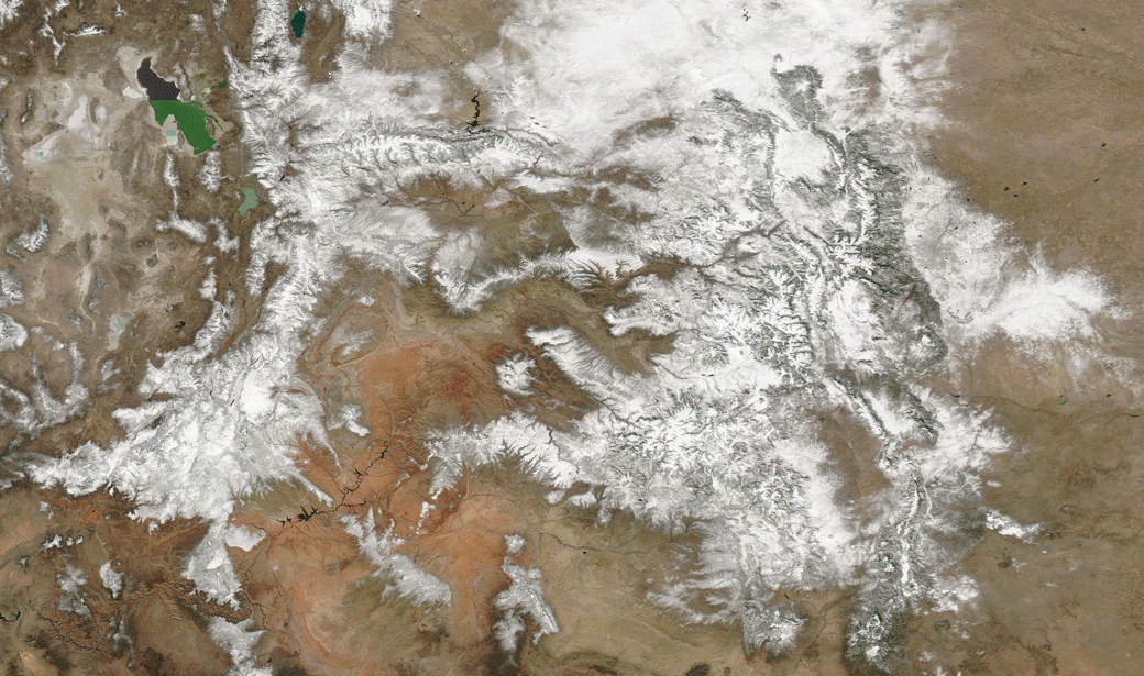
Before and after satellite images — one pair in natural color and the other in false color — show dramatic shrinkage in snowpack across a large portion of the Western United States centered on Colorado and Utah. In the false color views, snow appears in reddish tones. (Images: NASA Worldview. Animations: Tom Yulsman) On March 18th, I posted a story about the other big drought story you need to pay attention to — not the one in California, which has been garnering most of the headlines but the one that has been afflicting the Colorado River Basin. Since then, I've been keeping an eye on how our snowpack has been doing. And now, at the end of the month, I'm sorry to report that it's not doing well at all. The main culprit: High temperatures — outrageously so in some areas — have been causing premature melting of high mountain ...
Watch the West's Snowpack Shrink Dramatically Right Before Your Eyes in Striking Satellite Image Animations
The Colorado River Basin faces alarming snowpack shrinkage due to high temperatures, impacting water supply for millions.
More on Discover


Stay Curious
SubscribeTo The Magazine
Save up to 40% off the cover price when you subscribe to Discover magazine.
Subscribe