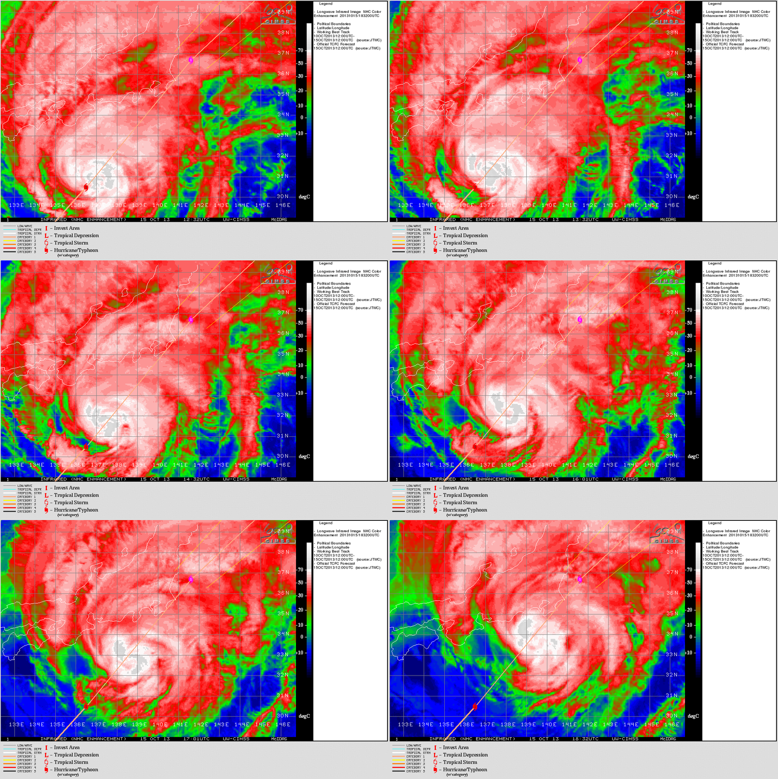
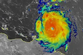
Typhoon Wipha bears down on Japan in this animated loop of false color satellite images. (Animation: CIMSS) As expected, massive Typhoon Wipha has curved to the northeast and is currently charging along the coast of Japan, drenching a large portion of the country in torrential rains.

Probability of 50 knot winds. (Source: JMA) As of early Wednesday morning in Japan, or about 2:30 p.m. MDT here in Colorado, Wipha's maximum sustained winds were clocked at 80 miles per hour, with gusts to 115 mph. The storm is expected to strike a glancing blow on Tokyo, a metropolitan area of 35 million people, with a 100 percent probability that winds will top 50 mph. (For details, click the thumbnail map at right from the Japan Meteorological Agency.) Meteorologist Jeff Masters of Wunderground.com expects Tokyo to be right at the edge of Wipha's hurricane-force winds. In addition to high winds, the forecast is for heavy rain and possible flooding. A major concern is the stricken Fukushima nuclear complex to the northeast, where as of August, 300 tons of water contaminated with radioactive substances was reported to be leaking into the ocean every day. The Tokyo Electric Power Corp has been scrambling to prepare for Wipha's approach. From a Reuters dispatch today:
Tokyo Electric said it would pump out the rainwater expected to fall into protective containers at the base of some 1,000 tanks storing radioactive water. The radioactive water is a by-product of its jerry-rigged cooling system designed to keep under control reactors wrecked in a 2011 earthquake and tsunami. The rainwater that builds up will be pumped into an empty tank, checked for radioactivity, and if uncontaminated, released into the sea, the company said.
This is pretty worrisome. So stay tuned.


