

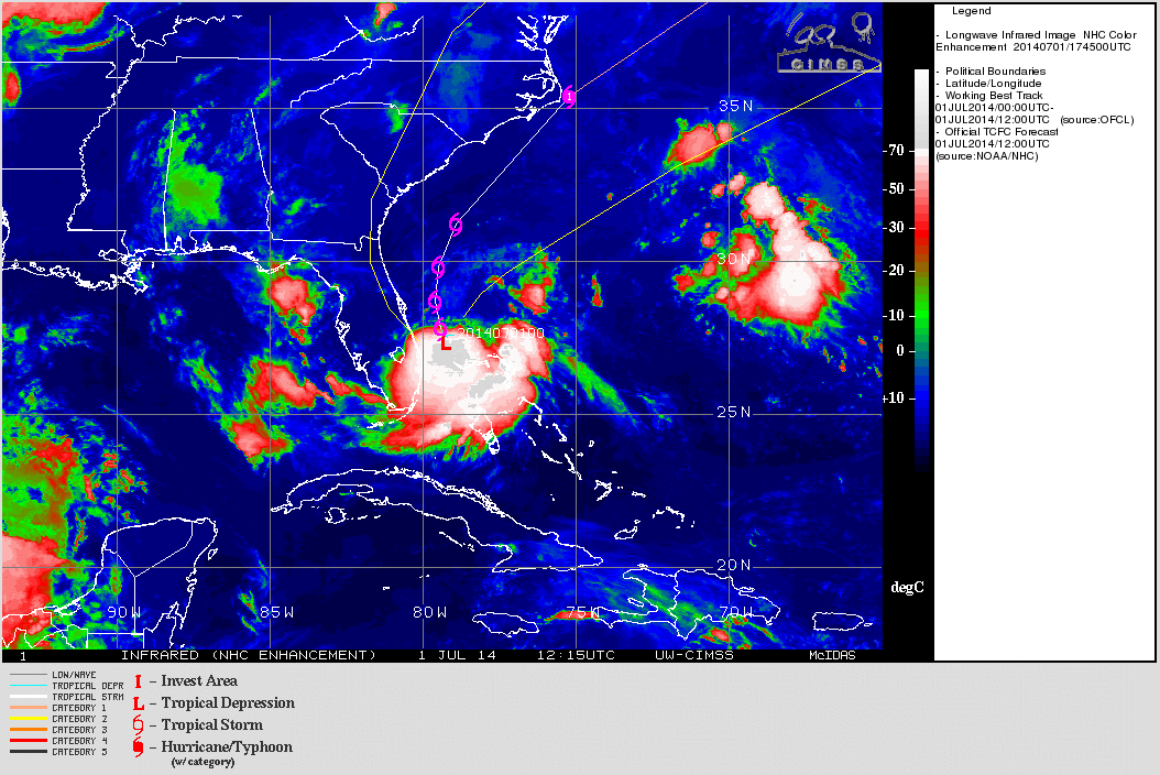
An animation of infrared satellite images shows Tropical Storm Arthur swirling off the coast of Florida today. (Note: The "L" in this animation indicates Arthur as a tropical depression. But it has been upgraded to a tropical storm. Source: Cooperative Institute for Meteorological Satellite Studies) It's finally here — the first tropical storm of the Atlantic hurricane season. He's named Arthur, and if you live along the Eastern Seaboard, he may upset your plans for July 4th. I emphasize "may," because at this point it is still difficult for forecasters to predict how Tropical Storm Arthur will evolve over the next four days. That said, forecasts of cyclone tracks are more accurate than strength predictions (as my colleague Andrew Freedman points out here). With that in mind, the animation of satellite images above shows Arthur tracking up the U.S. East Coast and coming very close to Cape Hatteras in the ...
Tropical Storm Arthur, First of Atlantic Hurricane Season, is a Possible July 4th Threat to N. Carolina's Outer Banks
Tropical Storm Arthur makes an early debut in the Atlantic hurricane season, potentially impacting the U.S. East Coast this July 4th.
More on Discover


Stay Curious
SubscribeTo The Magazine
Save up to 40% off the cover price when you subscribe to Discover magazine.
Subscribe