

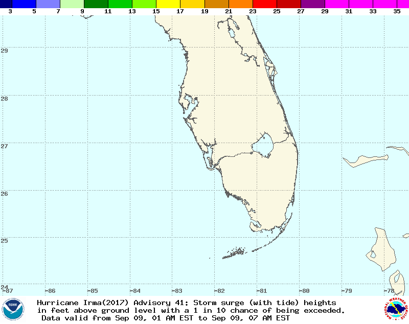
Forecast for storm surge Sunday, Sept. 9 at 1 p.m. through Tuesday, Sept. 12 at 7 a.m. (Source: National Weather Service) Hurricane Irma is a true monster, exceeding the size of Florida itself, and threatening to flatten structures throughout the state with extreme winds. But perhaps the biggest risk is now posed by storm surge – water pushed up onto land. The animation above shows an experimental forecast for storm surge from the National Weather Service. It shows the height of water above the land's surface in feet over time, from 7 a.m. EST today through 7 a.m. on Tuesday. (Sept. 9 - 12, 2017.) "Storm surge is often the greatest threat to life and property and directly accounts for about half of the deaths associated with tropical cyclones in the United States," according to the National Hurricane Center. With Irma now forecast to track up the Gulf coast of ...
The most extreme damage from Hurricane Irma may come from huge surges of water pushed onto land by wind
Prepare for life-threatening inundation as the storm surge forecast warns of dangerous conditions along Florida's coast.
More on Discover


Stay Curious
SubscribeTo The Magazine
Save up to 40% off the cover price when you subscribe to Discover magazine.
Subscribe