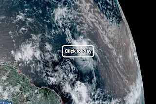
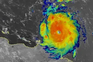
The GOES-16 weather satellite eyed Tropical Depression Four in the central Atlantic Ocean on Thursday afternoon, July 6, 2017, as it raced ahead of a huge blob of brownish dust streaming off the Sahara in Africa. (Source: CIRA/RAMMB/NOAA) It may have a humdrum name, but since Tropical Depression Four formed in the central Atlantic Ocean on Wednesday evening, it has certainly distinguished itself. It is a "small, tenacious depression" that "has continued to hold its own," the National Hurricane Center said in its update this morning. The spectacular animation above, from the GOES-16 weather satellite, suggests why that word, tenacious, is appropriate. Tropical Depression Four has managed to stay alive despite dry and dusty air streaming west from the Sahara in Africa. In the video, you can see the swirling depression racing ahead of a large mass of dusty, brown-tinged air. For a tropical depression to rev up and grow ...
The little storm that could: Watch a tenacious tropical depression race ahead of a huge blob of Saharan dust
Tropical Depression Four struggles in the central Atlantic, facing the Saharan Air Layer's dry and dusty air. Will it survive?
More on Discover
Stay Curious
SubscribeTo The Magazine
Save up to 40% off the cover price when you subscribe to Discover magazine.
Subscribe

