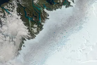
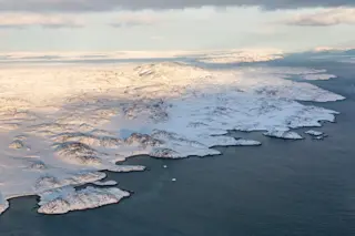
In this image acquired by NASA's Terra satellite, melt ponds are visible on August 2, 2013 atop the ice sheet along Greenland's western coast. (Image: NASA. Post-processing: Tom Yulsman) The melting season in Greenland peaked in late July, according to the latest report from the National Snow and Ice Data Center. When it is all over, NSIDC scientists project that the season will be much closer to the long-term average than last year — when more of the island's ice sheet melted than during any other year in the satellite record. The image above, acquired by NASA's Terra satellite, shows the surface of the ice sheet in western Greenland pockmarked by blue melt ponds, as well as what appear to be a lacy network of meltwater channels. The ponds are not unusual, as this part of the coast typically does experience melting in the summer. A good deal of the ...
Greenland Escapes Repeat of Last Year's Record Melting
Explore the Greenland melt season's peak effects revealed by the NASA Terra satellite and a decrease in overall ice loss this year.
More on Discover
Stay Curious
SubscribeTo The Magazine
Save up to 40% off the cover price when you subscribe to Discover magazine.
Subscribe

