

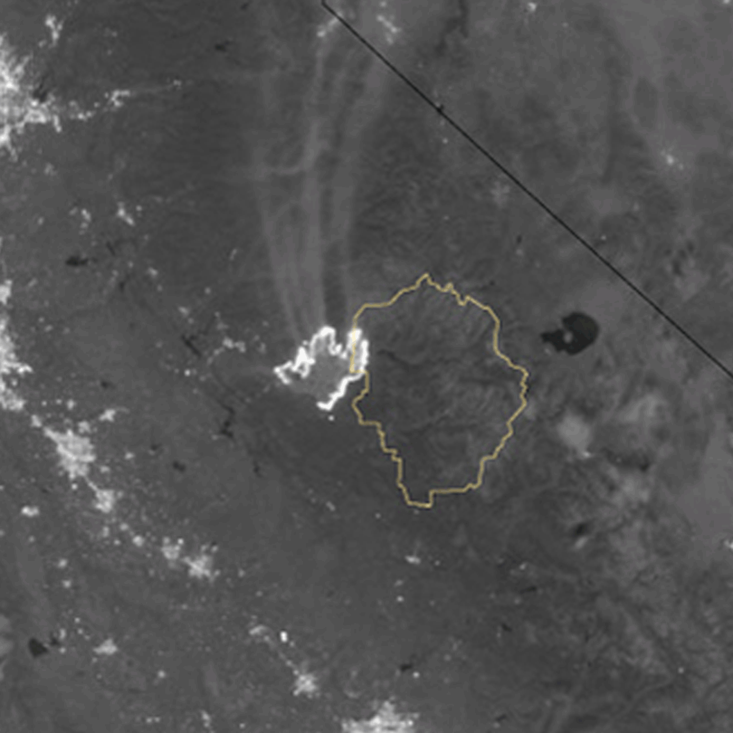
The growth of California's Rim Fire as tracked by the Suomi NPP satellite on the nights of August 23 through the 26th. (Image: NASA Earth Observatory) On Monday morning, I published two images and an animation showing California's dangerous Rim Fire from the vantage of space. Since then, additional imagery has become available, so I thought I'd share those with you too. The animation at the top of the post consists of four images from the Suomi NPP satellite published by NASA's Earth Observatory. Captured at night, the pictures show the fire as it evolved from August 23 through August 26th. Yosemite National Park is outlined in yellow.
Progression of the Rim Fire Aug 17-26. (Map: Inciweb) Inciweb, an interagency incident information web site, published a detailed, color-coded map showing the evolution of the fire. Click on the thumbnail at right to see it. As the map shows, the blaze ...


