Antarctica's Dry Valleys, Frozen in Time

May 31, 2013 11:00 AMNov 20, 2019 8:18 PM

Newsletter

Sign up for our email newsletter for the latest science news
 
Photo Credits: Keith Heyward ©Prehensile Productions

The rock formation known as the Dias rises in the distance above Upper Wright Valley, part of Antarctica’s Dry Valleys region, in which most of the glaciers are buried beneath thousands of years of accumulated rubble. Little surface ice is visible, unlike the other 98 percent of the continent.

Photo Credits: Jennifer Berglund ©Prehensile Productions

Photojournalist Keith Heyward sets up a shot on the rock formation known as the Dias in Upper Wright Valley. Photography is a special challenge in Antarctica, where subzero temperatures and vicious winds can wreak havoc on equipment and exposed skin.

Photo Credits: © Sean Mackay

Geologist David Marchant of Boston University has spent more than 20 research seasons in the Dry Valleys of Antarctica, discovering not only how the region formed and evolved over time, but possible analogs to the geology of Mars.

Photo Credits: Keith Heyward ©Prehensile Productions

A large sandstone boulder sits on the floor of Central Beacon Valley. Like most of the Dry Valleys, Beacon is lined by craggy layers of reddish-brown bedrock and lighter-colored sandstone. It’s a palette that might be mistaken for the balmy American Southwest, though the temperatures here rarely make it above freezing for more than a day or two.

Photo Credits: Keith Heyward ©Prehensile Productions

Protected from development or resource extraction by the International Antarctic Treaty, the Dry Valleys — including Upper Beacon Valley, shown here — are considered one of the most pristine landscapes on the planet.

Photo Credits: Jennifer Berglund ©Prehensile Productions

The tents and outbuildings of a remote field camp on the shores of Lake Bonney in the Dry Valleys, in the shadow of Taylor Glacier, provide a sense of scale often difficult to convey in photos of Antarctica, where distances are vast and typical human landmarks such as power lines are absent.

See more stories and multimedia from the Dry Valleys in this special report.

Photo Credits: Jennifer Berglund ©Prehensile Productions

On the return helicopter ride from the Dry Valleys to her first shower in weeks at McMurdo Station, Berglund snapped this image of Blood Falls, a spot where saltwater — colored rusty-red by iron oxide — flows from the tongue of Taylor Glacier.

Photo Credits: Jennifer Berglund ©Prehensile Productions

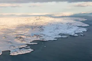
Traveling by helicopter from the main American base of McMurdo Station on Ross Island to the Dry Valleys, researchers fly over a portion of the Ross Ice Shelf and then a corner of the mesmerizing white spread of the East Antarctic Ice Sheet, which is the largest in the world.

Photo Credits: Jennifer Berglund ©Prehensile Productions

Ice falls above the geological formation called the Labyrinth can create a false sense of movement among the Dry Valley glaciers. Due to consistently below-freezing temperatures, ice that appears to be flowing can actually remain in place for thousands of years. Ice hidden beneath rubble can remain virtually unchanged for millions of years.

Photo Credits: Jennifer Berglund ©Prehensile Productions

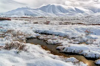
A rare snow dusts Upper Beacon Valley. With humidity lower than the Sahara, Antarctica is a desert, and snowfall, particularly in the Dry Valleys, quickly evaporates. The yellow Scott tents of the field camp are based on a design that has changed little since its namesake, explorer Robert F. Scott, first set foot on the continent more than a century ago.

Photo Credits: Jennifer Berglund ©Prehensile Productions

Graduate student and seasoned Antarctic researcher Sean Mackay balances on an outcrop of rock overlooking the Labyrinth, the remains of a 12-million-year-old subglacial flood that released nearly 13 times the volume of the entire Amazon River in a single explosive event.

Photo Credits: Jennifer Berglund ©Prehensile Productions

Photojournalist Keith Heyward uses a dolly to film above a formation in the Dry Valleys known as the Labyrinth, a series of deep troughs and ridges that researchers believe was carved out in a massive subglacial flood roughly 12 million years ago.

Photo Credits: Jennifer Berglund © Prehensile Productions

An austral summer sun — above the horizon 24 hours a day from late October until late February in this region of the continent — glints off the East Antarctic Ice Sheet. Together with the West Antarctic Ice Sheet, it blankets an area roughly the size of Mexico and the United States combined. In some places it is nearly three miles thick.

Photo Credits: Jennifer Berglund ©Prehensile Productions

A helicopter refuels near Taylor Glacier in the Dry Valleys as a field station team helps to dig out stored barrels of fuel. Helicopters are the only means of transportation between the Dry Valleys’ remote, seasonal field camps and McMurdo Station, the hub of the U.S. Antarctic Program, on Ross Island some 60 miles away. 

Photo Credits: Keith Heyward ©Prehensile Productions

Dramatic skies shadow an equally dramatic story in the valley below: a massive subglacial flood roughly 12 million years ago carved deep trenches in the bedrock, leaving behind a formation known as the Labyrinth. 

Photo Credits: Keith Heyward ©Prehensile Productions

In Central Beacon Valley, rocks that may have lain in situ for millions of years fit together like the paving stones of a Roman road — but, thanks to Antarctica’s extreme climate, they have gathered no moss. 

Photo Credits: Keith Heyward ©Prehensile Productions

Writer Jennifer Berglund poses above the Labyrinth wearing the cumbersome white “bunny boots” that are standard issue to most researchers passing through Christchurch, New Zealand, and on to Antarctica’s McMurdo Station. The clown-like boots have several layers of insulation and valves that restrict airflow to keep feet warm in subzero conditions, but are notorious for a lack of traction.

Photo Credits: Jennifer Berglund ©Prehensile Productions

The Dry Valleys’ infamous and persistent winds erode its rocks into often fantastical shapes known as ventifacts, such as this example from the Central Beacon Valley.

Photo Credits: Jennifer Berglund ©Prehensile Productions

Geology graduate student Sean Mackay exposes ancient ice buried beneath rubble in Beacon Valley. He models the standard-issue parka of the National Science Foundation’s U.S. Antarctic Program, affectionately known as “Big Red.”

1 free article left
Want More? Get unlimited access for as low as $1.99/month

Already a subscriber?

Register or Log In

1 free articleSubscribe
Discover Magazine Logo
Want more?

Keep reading for as low as $1.99!

Subscribe

Already a subscriber?

Register or Log In

More From Discover
Recommendations From Our Store
Stay Curious
Join
Our List

Sign up for our weekly science updates.

 
Subscribe
To The Magazine

Save up to 40% off the cover price when you subscribe to Discover magazine.

Copyright © 2024 LabX Media Group