

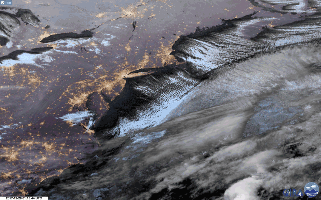
An animation of nighttime images captured by the GOES-16 weather satellite on December 28, 2017. Long, parallel bands of cumulus clouds are seen streaming out over the Atlantic. (Images: RAMMB/SLIDER. GIF animation: Tom Yulsman) Baby, it's cold outside! If you live pretty much anywhere in Canada, or in the United States east of the Rockies, that wonderful song from the 1940s pretty much sums up the conditions as 2017 draws to a close. And when revelers watch the ball drop in New York City's Times Square on New Years Eve, they will have to endure forecast temperatures of 10°F – with a wind chill of -5°F. The brisk northwesterly winds that have carried the bitterly cold Arctic air have given rise to beautiful cloud formations over the Atlantic Ocean. You can see them in the animation of above, consisting of GOES-16 satellite imagery: long, parallel rows of cumulus clouds pouring ...
Curiously aligned cloud formations stream across the Atlantic as Arctic air blows above warm ocean waters
Discover the stunning imagery from the GOES-16 weather satellite revealing cloud streets amid Arctic temperatures in North America.
More on Discover


Stay Curious
SubscribeTo The Magazine
Save up to 40% off the cover price when you subscribe to Discover magazine.
Subscribe