A Space-Age Journey into the Past with Albert Lin

Out There iconOut There
By Corey S. Powell
Oct 26, 2019 3:30 PMNov 14, 2019 4:47 PM
Screen-Shot-2019-10-26-at-3.27.11-PM-1024x514
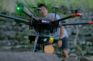
Albert Lin with one of his drones, preparing to explore the Nan Madol site in Micronesia, in a scene from Lost Cities. (Credit: National Geographic)

Newsletter

Sign up for our email newsletter for the latest science news
 

One of the happy surprises of the space age is that the same technologies propelling our civilization into the future have also proven hugely valuable for recovering lost details of civilizations in our past. Over the past three decades, satellite imagery and space-based radar have been used to locate more than 1,000 unknown ancient tombs in Egypt, to investigate the construction of the famous statues on Easter Island, even to track down the legendary lost city of Ubar.

Explorer and engineer Albert Lin is continuing this high-tech journey back in time. He uses drones and LIDAR (light detection and ranging) imaging to peel back centuries of overgrowth or to peer through modern cities, exposing hidden archaeological structures and lost details about the cultures that built them. The new series Lost Cities on the National Geographic channel showcases his work in a giddy but honest style: The technology opens new vistas into the past, but it doesn’t answer all the questions. Much like memory itself, the surviving evidence of humanity’s past is inevitably incomplete and open to interpretation.

Lin is the driving force behind Lost Cities, both with his technological innovations and with his joyful, open-ended passion. The show also treats his own intimate technology in a refreshingly matter-of-fact way: Three years ago, Lin lost his right leg in a car crash. He now has a prosthetic, which not only doesn’t slow him down, it sometimes seems to give him an advantage.

I spoke with Lin about his explorations, the changing tools of archaeology, and his shifting perspective on ancient civilizations. An edited version of our conversation follows.

How did you get involved in this project?

It goes back to my time in university. I studied all kinds of different engineering, and I was surrounded by a bunch of other graduate students who were also engineers and just amazing people—badass rock climbers and surfers, and all kinds of other adventurers.

Then I read an article about rock climbers who had found a cave up in the Mustang region of Nepal where glaciers had carved away the sides of the cliffs and kept the caves completely isolated, so they were like little time capsules into a different era. I remember thinking that the age of discovery, that thing that I grow up with dreaming about, is still very alive and real.

How did you put that thought into action?

When I finished my graduate degree at UC San Diego, I sold everything I had and I gave myself one year, living out of my car, to raise money to launch an expedition in Mongolia, using satellites and drones and radar systems or whatever other technology I could develop or get access to, to try to find the tomb of Genghis Khan. My grandparents thought that we came from the North, from Mongolia, so I was really on a quest to find more about my own ancestry.

When I got there, I realized that there was almost nothing known about this person who in a single lifetime went from being an outcast tribal slave to creating the largest empire in human history. How did that happen? What does that mean about the human spirit? None of the tombs of him or any of his sons or grandsons had ever been found. That’s when the idea of applying technology to search for these human stories originated in my heart.

That was about ten years ago. How has the technology changed since then, opening up new ways to look into the past?

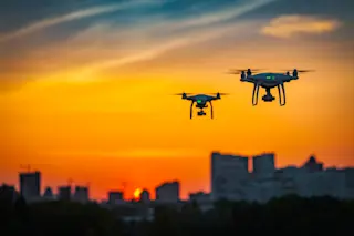
One of the most I would say remarkable technological advances I’ve seen in the last ten years has been drone technology. When I started out, we were scraping together random spare parts to piece together little odd drones that would carry cameras on them to do remote sensing. They would crash all the time. Now you can pretty much buy a drone at 7-Eleven.

The new drones can fly in incredible winds for long period of time, at high altitudes, through narrow canyons with great agility. And they can carry sensors and payloads that you couldn’t have flown before, like LIDAR, laser scanners. Instead of having a helicopter or a Cessna flying over these remote locations, you can put them on little drones and hike them out on the back of a horses or pack mules. We did that at the top of the mountains in Peru just last month.

Aerial view of Nan Madol shows how eight centuries of growth and erosion has erased much of what the structures there once looked like. (Credit: National Geographic)
Digital reconstruction of Nan Madol, based heavily on Lin’s LIDAR studies, reveals a complex set of seawalls, fortifications, and settlements. (Credit: National Geographic)

What does that technology do for you? What kind of history have you uncovered?

With LIDAR scanners, you can delete everything that gets hit by the signal before it makes it to the ground. You can essentially delete the trees and shrubs. And you’re left with these maps of people’s realities from thousands of years ago, worlds that had been overgrown by the hands of nature. Those lost cities, those ruins, tell important stories about how we organize ourselves and about what we’re capable of.

How long did it take to put together Lost Cities?

It took me three years to develop the first project, and then in a single year we’ve gone to six different worlds. Every time I prepare myself as much as I can, but every time I get on the ground somewhere, my reality is completely rewritten.

For example, I was in Peru high up in the Andes about a month and a half ago. When you think of Peru you think of places like Machu Picchu. Don’t get me wrong, Machu Picchu is incredible. It has these stones that are perfectly carved, fit together like a jigsaw puzzle in ways that you could never imagine stone tools being able to create. But if you just see it for the stones, you’re missing a huge part of the story.

It took me weeks to figure it out. When I got further and further into the experience of being on this expedition, I started to realize that Machu Picchu wasn’t just a city or a palace. It was like a social tuning fork for the ceremonies and rituals that connected people to nature in a fundamental way.

“A social tuning fork.” What do you mean by that?

People at Machu Picchu talk about Pachamama, mother earth, a leader of things. But when we went up to another site farther away, a lesser-known location high up on a mountainside that was built before the Inca, you see the early beginnings of all this. I was talking to a Peruvian archeologist, Anand, and he was telling me about two burials he had found that were built by the pre-Inca. The doors [of the burials] were paired together, pointing in a specific direction.

I asked Anand, “Why are they pointing in that direction?” He’s says, “Well, they lead up there, from those mountains.” And I thought, “Oh, so maybe there’s another city over in those mountains.” He said, “No you don’t quite understand. They believe they were literally born out of the mountain, that they were the mountain, that they were rock and stone and ice and snow. They came from that and they became humans, and now they’re back into it.”

At first it sounds wild, but then you think about that from an ancestral standpoint and it’s true. We are part of nature. Our elements, what we are, human life, is born from the same rock. Now I look at the entire Peruvian landscape as a world built around the belief that we are from nature itself. We are not separate from nature. We are nature.

How did modern imaging technology help you connect that concept with the actual traces those civilizations left behind?

We scanned this place using lasers on high-altitude drones to map the top of these mountains, which previously had only been surveyed using traditional archeology. When you use the lasers to do it, you can delete all the tall grass and intense cacti that make this area impenetrable. All of a sudden, the entire mountain was exposed, revealing an unusual path. The top of the mountain was shaped by the pre-Inca, and then by the Inca, in the same way that was later applied to the world of Machu Picchu.

Were there other notable moments while working on Lost Cities when you had a similar moment of clarity, when the LIDAR images let you see through history to an underlying truth?

Yeah, certainly. We were in Jordan maybe three months ago. Petra, one of the most iconic archeological sites in the world, is carved into immense cliff sides there. How did they build it in this totally arid desert? When you’re on the ground in the desert it’s hard to see the subtle details in the landscape. If you look from above, you realize the whole city was built as this massive network of channels. It’s almost like as if you looked at an electrical board, but instead of wires connecting electrons, it’s channels collecting water on every flat surface and channeling it into underground cisterns.

Then using drone-based LIDAR and photogrammetry [making measurements and 3D reconstructions from digital images], you can pull back farther and you realize that the entire desert surrounding it was created as a series of washes that would slow the water down and filter it as it moved. It was a huge water-catching engineering masterpiece designed to allow for this place to survive.

Some Bedouin nomad imagined water-caching systems that allowed them to bring life to an arid desert. They built it thousands of years ago, and it eventually let them build empires.

Lin with archaeologist Santiago Giraldon at Ciudad Perdida in Colombia. (Credit: National Geographic)

What about using LIDAR to look through the jungle? That seems like one of the most dramatic applications.

Yes, there was this series of terraces way up high in the jungles of Columbia that we could only find using LIDAR to delete the jungles. We went out there with a Colombian archeologist, Santiago Giraldo, who has spent 30 years at this site on the Sierra Nevada of the Tayrona civilization. There’s a remarkable terraced city high up in the jungles, and he had known that there’s another city out there because there’s large stone of entrance that has what looks like be a map system built into it. But nobody knew where those other cities are, because it’s all overgrown and it’s super-dangerous to get to.

Having LIDAR data, we could see where those terraces might be. We bushwhacked out there through the jungle with machetes and a military platoon. We finally got to these places and we found evidence of a lost city, a real lost city high up in the mountains or a lost settlement.

That alone kind of justifies the title of your series! What other discoveries stand out?

Some of them can be really subtle. I was in the northernmost part of Norway, by the border of Russia, where the sun never really sets there at this time of year. With the sun just hovering over the skyline, the light glinted off of these granite boulders. They gave away to the faintest signature of hunter-gather murals, rock-art pieces faintly inscribed in the stone. We were able to scan these rock pieces in detail and accentuate the rock carvings and then digitally move the light around them.

Staring right back at me were these incredible pictures. For instance, they used the stone as a three-dimensional topographical map. When it rained, water collected in that boulder, it turned into a lake with footprints of a bear going up to it. There were also stories of a specific person ingrained into the stone. There was a guy sitting on a boat in the middle of an ocean, and there’s a long, long line going straight down to what appears to be deep in the sea. And at the end of that line, a massive halibut.

You you think to yourself, 10,000 years ago or more, how did somebody without any modern technology ideate that there might be a monster at the bottom of that ocean and that they could get out on top of it somehow. They built some kind of craft and they wove together a rope, I don’t know with what, that was hundreds of feet long and strong enough to pull up a massive Arctic halibut. How does that happen?

It makes you get humbled by the things that you take for granted, and with the long lineage of human experimentation that got us to where we are today.

Lin investigates the lost fortress of the Knights Templar in a makeshift field lab beneath the streets of Acre, Israel. (Credit: National Geographic)

How much of the past do you carry with you now? Do you see traces of it everywhere you go?

Very much so. I sometimes just stare at Google Maps and look down. If you look at any major city today, you would think that they all kind of look the same, but they really don’t. You go to a place like Mexico City and you compare that to Tokyo or you compare that to New York, you compare that to San Francisco. They’re all completely different blueprints of how we organize ourselves as human beings.

And I bet you that the way in which we organize ourselves, with our roads and buildings and things like this–I bet it completely transforms our human condition. How we see the world around us, how we experience life. I’m a father of two young kids, and I think about how many different ways there are to live our lives through our choice of perspective. We’ve seen that through the ages, through the many different versions of our human story.

What would you like to see that today’s imaging doesn’t let you do? Where do you hope the technology goes next?

There could be better ways to use ground-penetrating radar and to visualize the massive amounts of information. We constantly try to tinker and come up with new ideas. That’s been going on through many generations. I do think, though, that we are at the cusp of the golden age of exploration.

The things that we can do now to look for and find new things are remarkable. But the lessons that we learn from those stories—finding out who we are, where we came from, the wonders we can achieve—we must apply them to create a better world for the future. Because you can only know where you’re going when you know where you come from.

1 free article left
Want More? Get unlimited access for as low as $1.99/month

Already a subscriber?

Register or Log In

1 free articleSubscribe
Discover Magazine Logo
Want more?

Keep reading for as low as $1.99!

Subscribe

Already a subscriber?

Register or Log In

More From Discover
Recommendations From Our Store
Stay Curious
Join
Our List

Sign up for our weekly science updates.

 
Subscribe
To The Magazine

Save up to 40% off the cover price when you subscribe to Discover magazine.

Copyright © 2024 LabX Media Group