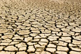
For years, farmers in Kenya's arid north have suffered huge losses when droughts wiped out their cattle herds. Now, they have a means to protect their sole source of livelihood when rains fail and grasslands disappear. A new insurance scheme hopes to safeguard cattle-rearers in northern Kenya's drought-prone Marsabit district by using satellite imagery to track changing landscapes and the subsequent loss of cattle. The program, launched by the International Livestock Research Institute, is being billed as the world's first insurance program to track changing pastoral grounds. When the satellite photos reveal that a verdant green landscape has changed to a dry brown, the insurance kicks in and farmers can collect their payments. The program will make things easier for insurance companies--for whom estimating losses in the past has been all but impossible.Partly because it has simply been too expensive for insurers to go and count the number of dead animals which might be spread over a vast rural area
[BBC].
The scheme's launch comes at a time when the Marsabit region has suffered
28 droughts in the last 100 years and four in the past decade alone [Kenya Broadcasting Corporation].
The program will be run by a Kenyan bank in partnership with a local insurance firm.
The initial aim is to get 1,000 families in northern Kenya to insure their cows, goats, sheep and camels. To insure a herd of 10 cows for example a family would pay the equivalent of around $50 [BBC]
. That may sound like a lot of money for cattle-herder in the developing world, but it represents less than a third of the value of a single cow. For many farmers, the cattle are the sole means of livelihood, so protecting them through insurance seems to be a good idea. Marsabit is home to more than 2 million cows, camels, goats and sheep, worth an estimated $67 million. Livestock here is rarely sold or slaughtered--instead, families depend on them for milk and routinely drink their blood for nutrition. For now, the scheme has been launched just in the Marsabit District--if it works well, then it will be launched across Africa. The program has some precedents:
In Mongolia, a different form of insurance brings payouts for all pastoralists if severe snowstorms kill animals in benchmark herds [News24].
Related Content: 80beats: West Africa Is Prone to “Mega-Droughts,” But People Aren’t Prepared 80beats: Do Hot, Dry Conditions Cause More African Civil Wars? 80beats: Kenya’s Man-Eating Lions Not as Man-Hungry as Previously Thought 80beats: Elephants’ Tail Hairs Tell a Story of Competition on the SavannaImage: iStockphoto


