Live: Explore Deep-Sea Canyons Never Before Seen by Humans

D-brief
By Carl Engelking
Sep 23, 2014 8:51 PMNov 19, 2019 9:48 PM

Newsletter

Sign up for our email newsletter for the latest science news
 

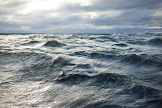
With about 95 percent still unexplored, the ocean is mankind’s final frontier here on Earth. And at this very moment you can join scientists from the National Oceanic and Atmospheric Administration in their quest to learn more about this deep blue void. The United States’ only federally funded ship designated for ocean exploration, the Okeanos Explorer, is on another mission to explore noteworthy sites at the bottom of the sea. This time, the crew is cruising off the coast of New England in the Atlantic Ocean gathering data about deep-sea canyons and mountain ranges. Above, you can watch live video feeds from the ocean rover

Deep Discoverer

and listen to scientists explaining what they’re seeing.

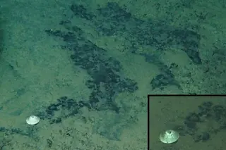
Screenshot from a Sept. 23 Deep Discoverer dive. (Credit: NOAA).

Ocean Roving

Today they’re sending the rover of a 4,200-foot dive to check out a minor canyon just east of Veatch Canyon. This is the fourth divewithin the third leg of their mission, which will conclude Oct. 7. This mission takes researchers to a deep-sea neighborhood that’s near one of the most populous regions of the United States. They’ll be gathering baseline data about the New England Seamount Chain, an underwater mountain range which has never been seen by humans. The data collected by the Okeanos team are important for both scientists and resource managers to better inform research and decision-making. Hey, it's not every day you get to explore never-before-seen parts of the seafloor without leaving your desk.

Map showing areas that will be explored during the second and third legs of the Our Deepwater Backyard: Exploring Atlantic Canyons and Seamounts 2014 expedition. Color-coded bathymetry, previously collected by Okeanos Explorer and by the University of New Hampshire’s Center for Coastal and Ocean Mapping UNCLOS expeditions, processed with QPS Inc., Fledermaus software. Map created with ESRI ArcMap software. (Credit: NOAA)

0 free articles left
Want More? Get unlimited access for as low as $1.99/month

Already a subscriber?

Register or Log In

0 free articlesSubscribe
Discover Magazine Logo
Want more?

Keep reading for as low as $1.99!

Subscribe

Already a subscriber?

Register or Log In

More From Discover
Recommendations From Our Store
Shop Now
Stay Curious
Join
Our List

Sign up for our weekly science updates.

 
Subscribe
To The Magazine

Save up to 40% off the cover price when you subscribe to Discover magazine.

Copyright © 2024 Kalmbach Media Co.