Grace in Space

Satellites accurately track Earth's squishiness.

By Sam Flamsteed
Mar 23, 2007 5:00 AMNov 12, 2019 5:56 AM

Newsletter

Sign up for our email newsletter for the latest science news
 

If the Reverend Nevil Maskelyne came back to life, the 18th-century Astronomer Royal of Great Britain would probably have no trouble grasping the idea behind NASA’s remote sensing GRACE mission. Maskelyne proposed a remarkably similar experiment himself in a presentation to the Royal Society in 1772. “If the attraction of gravity be exerted, as Sir Isaac Newton supposes, not only between the large bodies of the universe, but between the minutest particles of which these bodies are composed . . . it will necessarily follow, that every hill must, by its attraction, alter the direction of gravitation in heavy bodies in its neighborhood ....”

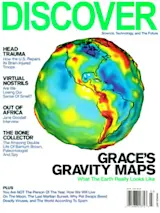
That’s exactly what GRACE, the Gravity Recovery and Climate Experiment, detects. Every 94 minutes or so, twin satellites whip once around Earth at an altitude of 310 miles, taking 30 days to cover the planet’s entire surface, then they do it again and again, sensing variations in local gravity. GRACE maps local variations in the force of gravity over Earth’s surface, revealing mountain ranges and ocean trenches as well as underground watersheds and other hidden concentrations of mass. A joint venture by NASA and the DLR (Deutsches Zentrum für Luft- und Raumfahrt, or German Aerospace Center), GRACE looks right past the familiar oceans, continents, and clouds, showing our planet in a fresh light—as a knobby, blobby globe of gravitational ups and downs.

Among other things, GRACE may have found a crater deep under the Antarctic ice that may mark an asteroid impact greater than the one that doomed the dinosaurs, measured the seafloor displacement that triggered the tsunami of 2004, and quantified changes in subsurface water in the Amazon and Congo river basins. “This is really an entirely new kind of remote sensing,” says project scientist Michael Watkins, of NASA’s Jet Propulsion Laboratory. “It’s like when radar or photography was first invented—you start realizing that it can be applied in all sorts of unanticipated ways. We’re still discovering them.”

The notion that Earth’s gravity field could be measured with satellites dates back to the dawn of the space age. In 1958 ground controllers tracking the first American satellite, Explorer 1, noted that its path faithfully traced the planet’s equatorial bulge (created by centrifugal forces generated by the planet’s rotation). By the 1960s rocket scientists realized that smaller, local variations in gravity could have further, unforeseen effects. Missiles carrying nuclear warheads, for example, could be thrown off course if no allowance was made for mountain ranges or valleys.

If Earth were a perfect sphere, perfectly uniform in density and covered to a uniform depth with ocean, the geoid—a word coined by geologists to refer to an imaginary plane located at the average level of the sea’s surface—would be a perfect sphere as well. Since the geoid would be evenly perpendicular to the pull of gravity in all places, that force would always pull you directly toward the precise center of the Earth. But Earth is nowhere near perfect or uniform, which means that gravity doesn’t always point straight down; a mountain range, for example, might divert it slightly to the left.

Understanding the subtleties of Earth’s gravitational field would be useful in many ways. Scientists could learn a lot about the structure of the planet, what it’s made of, and where the crust is thick or thin. A deposit of high-density underground rock, or an undersea mountain, is utterly invisible—yet they, too, skew the geoid away from perfect flatness. Even when the ocean is utterly calm, it isn’t flat. Measurements reveal that some parts of the ocean are a remarkable 390 feet lower than average, and others are 300 feet higher.

While scientists began to appreciate just how useful a map of the geoid could be, engineers were realizing that the most sensible way to measure the variations would be with a pair of satellites, instead of just one. A single orbiter would bob and weave with the gravity field just fine—but monitors would have to measure the ups and downs from the ground continuously by beaming radio waves back and forth. That would require an enormous network of ground stations. Yet two satellites flying far enough apart would experience different gravitational effects, so that only the distance between them must be measured. As the lead satellite approaches a place with more mass than average, it speeds up just a bit from the extra gravitational pull. Shortly thereafter, so does the second. Then, as the higher-mass region falls behind, each satellite is held back a little—again, first the leading, then the trailing satellite. By sending microwaves between the two, it would be possible to calculate that staggered acceleration, and thus infer the change in gravitational pull on Earth’s surface.

+++

Unfortunately, the variation in distance between the two satellites is so small that in the early 1960s it would have been virtually impossible to detect using any technology then available. In 1976 NASA launched a satellite called LAGEOS (Laser Geodynamics Satellite), which began to address the problem, albeit crudely. It carried no instruments at all. In essence, LAGEOS was a two-foot-diameter shiny brass golf ball; by bouncing laser beams off the satellite from different places on the surface of Earth, geologists could measure the precise distances between widely separated places on the planet. They could, for example, see the gradual separation of continents, due to plate tectonics, year by year.

In the early 1990s the TOPEX (Topography Experiment for Ocean Circulation)/Poseidon satellite, a joint American-French mission, shot into orbit armed with radar altimeters to measure the height of the sea surface. “What they’ve basically done,” Watkins says, “is to look at changes in the sea surface over time, on the assumption the geoid itself doesn’t change.” Except that sometimes it does. Along with its measurements of continental drift, LAGEOS also detected a very gradual change in the gravity field over Canada and northern Europe as the crust continues to rebound—10,000 years later—from the weight of the massive glaciers that pinned it down during the last ice age. It also revealed annual variations in local gravity due to the natural storage and depletion of water during rainy and dry seasons in different parts of the world.

Laser beams fired at LAGEOS were not sensitive enough to pinpoint variations in orbit smaller than a centimeter or so and were too imprecise to pick out the subtler differences in gravity. For that, a double-satellite mission was needed. Finally, in the mid-1990s, the technology to pull it off became available in two forms. The first was microwave transmitters and receivers small, efficient, and reliable enough to be to mounted on small spacecraft and used to gauge the distance between the satellites. The second: the Global Positioning System (GPS). “If I’m sending a signal from me to you,” says Watkins, “and I want to know the time of flight, it’s crucial that our clocks be perfectly synchronized.” By checking in constantly with whatever GPS satellite is in view at a given time, a pair of gravity satellites can use its single clock rather than trying to synchronize their own.

With the technology finally in place, Watkins, together with ­aerospace engineer Byron Tapley of the University of Texas at Austin and several other scientists and engineers, proposed the GRACE mission. In partnership with the German space agency, NASA sent the dual GRACE satellites into orbit in March 2002. Since then, they have been zipping around Earth in a polar orbit, one satellite about 137 miles ahead of the other. To an observer in space, they would appear to be tracing out the same circle over and over, but since the planet is continuously rotating beneath them, the intrepid satellites orbit over every slice of the surface once every 30 days.

Their instruments measure not the distance between the two satellites but rather the change in distance, and thus the acceleration due to gravity. They do it through interferometry—watching how beams of microwaves interfere with each other. One satellite shoots out a continuous stream of microwaves, which is received by the second satellite and both are sent to the ground. The outgoing and incoming beams are superimposed, creating an interference pattern that varies depending on how close the waves are to being perfectly in phase—that is, how close the waves’ peaks and valleys are lined up. A tiny difference in satellite-to-satellite distance—and thus an increase or decrease in gravitational pull from Earth’s surface—makes a marked difference in the interference pattern. If the satellites are moving together or apart at as little as 150 nanometers per second, the GRACE scientists can see it.

That is not quite the end of the story. Even though 310 miles up is technically outer space, a few air molecules still float around—not enough to make the slightest difference to astronauts on a space shuttle or the space station, which orbit considerably lower, but sufficient to slow the GRACE satellites perceptibly. A clump of air molecules could fool an observer into thinking that something lies below—perhaps a glacier—so each satellite has what’s known as a “proof mass” floating in a chamber inside, untethered to the satellite itself. The proof mass is itself in orbit, so when one of the satellites speeds up or slows down due to gravity variations, the mass does too. But when a satellite slows due to air drag, the proof mass inside, blissfully unaware, keeps moving at its original speed. It doesn’t hit the interior wall of the satellite because onboard electric plates keep it from doing so—but sensitive electronics keep track of the discrepancy so the engineers can subtract it from the real signal.

+++

GRACE’s data are open to any scientist on the planet. “That,” says Byron Tapley, “led to a whole range of people outside the standard community who used GRACE results to do things that weren’t possible before.” In January 2005, for example, Ohio State University geophysicist Ralph von Frese and his colleagues noticed a concentration of higher-than-average-density material in the rock about a mile under the surface of the East Antarctic ice sheet. Mass concentrations like this often accumulate when giant impacts from space pound the crust. When the crust rebounds, it carries higher-density mantle materials up toward the surface and holds them there. Comparing the GRACE data with radar imagery of the icebound bedrock, von Frese found it was centered perfectly inside a ring some 300 miles wide—just what you’d expect from an impactor 30 or so miles across. “It just jumped out at us,” he says.

An asteroid that big would be about four to five times the diameter of the object that killed off the dinosaurs 65 million years ago. This crater is much older, arguably dating back to a time, some 250 million years ago, when something—perhaps a projectile from outer space—wiped out the majority of the species on Earth, including most reptiles, sponges, corals, starfish, clams, sea scorpions, and fish, thereby clearing the evolutionary decks for dinosaurs to become dominant. That was the greatest mass extinction in history, and thanks to GRACE, paleontologists and evolutionary biologists now have an idea of how it may have happened.

But GRACE’s greatest contribution comes from the fact that it remeasures the geoid every month or so. That enabled geologists to make before-and-after assessments of how the seafloor rearranged itself in the Sumatra-Andaman earthquake of December 26, 2004, which triggered the awful Indian Ocean tsunami. “When a major quake happens on land,” Watkins says, “you can go out and look at the changes. With GRACE, we can now look thousands of feet underwater as well.”

The satellites can also reveal movement of water itself, in ways never possible before. “It’s very cool, because water can go underground, it can move around the ocean, it can change from ice to liquid and runoff, but it can’t hide its mass from us,” says Watkins. Imagine, he says, a gigantic hockey puck made of water. “It could be in the form of an ice sheet, or an aquifer, or a piece of ocean. GRACE has the sensitivity to pick up a puck about a centimeter thick and 400 kilometers [half an inch and 250 miles] across.” All the water on Earth can be divided into hockey pucks, he says, and GRACE takes note of how they move around every 30 days.

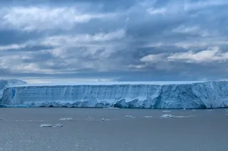
Last March, geophysicists Isabella Velicogna and John Wahr at the University of Colorado at Boulder published a paper in Science Express that used GRACE data to show that the ice sheet covering Antarctica has shrunk by an average of 36 cubic miles of ice per year—surprising, given that many climate models predict a thickening of the ice as higher global temperatures lead to more evaporation and precipitation. “It’s very difficult for models to reproduce the physics of glaciers, and this shows that the models aren’t as good as we’d like them to be,” Velicogna says.

Velicogna and her colleagues also measured a dramatic loss of Greenland ice, as much as 38 cubic miles per year between 2002 and 2005—even more troubling, given that an influx of fresh melt water into the salty North Atlantic could in theory shut off the system of ocean currents that keep Europe relatively warm. (A separate group at the University of Texas published figures extrapolated from GRACE data showing that Greenland lost as much as 57 cubic miles of ice each year between 2002 and 2005; NASA shortly plans to publish data reconciling the two studies.) “It’s a wake-up call,” says Velicogna, “because there is a lot of water that can go from the ice sheets into the ocean. Both ice sheets are significantly losing mass, and that affects sea level. If sea level is going to rise, that will affect a lot of coastal areas.”

This past December an entire session of the American Geophysical Union’s fall meeting was devoted to movement of water in and out of giant watersheds all over the world. Speakers presented eight papers, on topics ranging from the hydrologic impact of the Three Gorges Dam in China to the impact of climate change on Siberian river systems. All the new findings were based entirely on data from GRACE. Notable results included a report from researchers at MIT that Alaska lost an average of 10 and a half cubic miles of ice each year from 2003 to 2005.

Oceanographers, geologists, and climatologists are scrambling to update their models of the planet based on the flood of GRACE data. But these will start to look positively primitive when a new, upgraded version of GRACE comes along in several years. Armed with laser interferometers more sensitive than the microwave type, GRACE scientists will be able to attain much better resolution, and thus to find even subtler gravity variations and more exquisite detail, or “smaller hockey pucks,” in Watkins’s words. Nevil Maskelyne never managed to make his own experiment work, but with GRACE his idea has been vindicated beyond even his wildest imaginings.

1 free article left
Want More? Get unlimited access for as low as $1.99/month

Already a subscriber?

Register or Log In

1 free articleSubscribe
Discover Magazine Logo
Want more?

Keep reading for as low as $1.99!

Subscribe

Already a subscriber?

Register or Log In

More From Discover
Recommendations From Our Store
Shop Now
Stay Curious
Join
Our List

Sign up for our weekly science updates.

 
Subscribe
To The Magazine

Save up to 40% off the cover price when you subscribe to Discover magazine.

Copyright © 2024 Kalmbach Media Co.