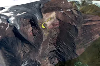
When a landslide tore through a remote Alaskan valley in July, no one was there to bear witness. But hours later, geoscientist Colin Stark of the Lamont-Doherty Earth Observatory spotted the event in the pattern of seismic waves passing through the Earth’s crust. Within days, using data from earthquake sensors and satellite images, he and colleague Göran Ekström were able to estimate, from their lab in New York, the landslide’s size, and even determine its path.
The forces generated by landslides aren’t as well understood as those that occur during earthquakes, partly because landslides often strike unpopulated areas with no observers. As a result, landslides leave few clues to how they unfold, making it difficult to predict them or prevent damage the next time.
When humans do live nearby, the consequences can be dire. In 2000, a landslide on the Chinese-Indian border went unnoticed. The rubble created a dam that ...


