

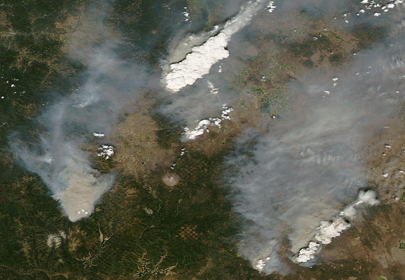
Natural and false color views of wildfires burning in California and Oregon alternate in this animation of images captured Aug. 2, 2014 by NASA's Aqua satellite. (Source: NASA) Wildfire activity is really picking up in California and Oregon, thanks to extreme drought, high temperatures and lightning crackling across the region. In California alone, the area burned by wildfire has quadrupled since last Wednesday. The animation above consists of natural and false color satellite images acquired yesterday by NASA's Aqua satellite. In it, I count at least five wildfires. The biggest plume, toward the top, is streaming from a fire in the lightning-started Beaver Complex, which as of this morning had burned about 32,000 acres and was only 10 percent contained, according to Inciweb. The complex consists of the Salt Creek Fire about 20 miles northwest of Medford, and the Oregon Gulch Fire about 15 miles east of Ashland. The latter ...
Heat, Drought and Lightning Spark Upsurge in Wildfires
Severe California wildfires escalate due to extreme drought, high temps, and lightning, impacting air quality and landscape.
More on Discover


Stay Curious
SubscribeTo The Magazine
Save up to 40% off the cover price when you subscribe to Discover magazine.
Subscribe