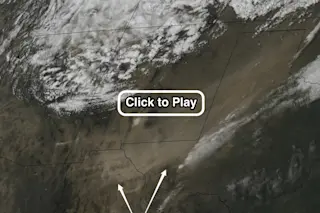
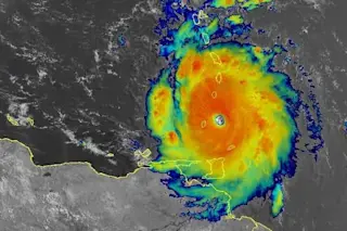
The GOES-16 weather satellite captured this view of large plumes of blowing dust originating from southeastern Arizona, New Mexico, Texas and Mexico on April 10, 2019. (Source: Cooperative Institute for Meteorological Satellite Studies) As the latest monster spring storm spun up over the U.S. Four Corners region on April 10, high winds drove huge amounts of dust all the way north to the Upper Midwest, where it fell as dirty snow. You can see the low-pressure center of the cyclone spinning counter-clockwise in the animation above of GOES-16 weather satellite images. Below it, watch for the gargantuan plumes of khaki-colored dust being swept up and driven to the northeast. Also check out the lighter, sand-colored patch (right under 'click to play'). This is White Sands National Monument in New Mexico, and the dust streaming from this area is lighter in color. The storm system, dubbed a "bomb cyclone" by meteorologists ...
The latest bomb cyclone swept dust from Mexico and Arizona all the way north to Minnesota
Explore the dramatic impact of the GOES-16 weather satellite on a blowing dust storm that swept across the U.S.
More on Discover
Stay Curious
SubscribeTo The Magazine
Save up to 40% off the cover price when you subscribe to Discover magazine.
Subscribe

