SoCal and Mexico Blazes as Seen From Space

ImaGeo iconImaGeo
By Tom Yulsman
May 15, 2014 7:52 PMNov 20, 2019 1:26 AM
SoCal-Fires.gif

Newsletter

Sign up for our email newsletter for the latest science news
 

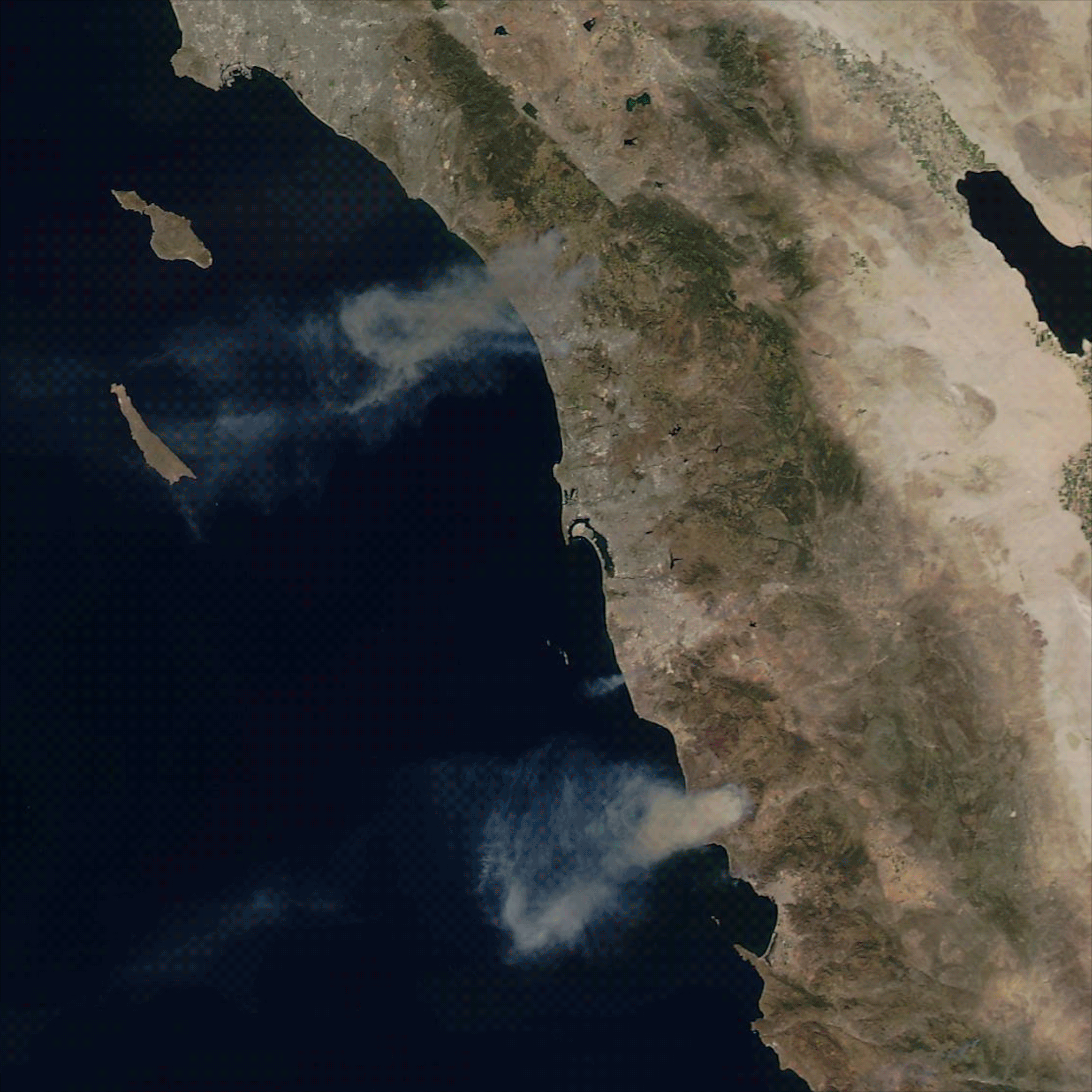
This animation of images captured by NASA's Aqua satellite on Wednesday, May 14, shows wildfires north of San Diego and neighboring Mexico. One image portrays the scene in natural color, the other in a false color scheme that highlights areas of burned vegetation in bright red. (Source: NASA) Nine fires are now burning on more than 9,000 acres in California's San Diego County. Since the first fire outbreaks yesterday, more than 20 residences have been destroyed, with total damages estimated so far at $22.5 million. For up to date official information on these and other blazes in California, see the state's Current Fire Information website. Hundreds of firefighters have been battling the blazes since yesterday. Luckily, though, there have been no reports of deaths or major injuries. Yesterday, I posted a story that included a satellite image of the wildfires as seen by NASA's Terra satellite. Smoke plumes were clearly visible, but the image wasn't quite tack sharp. Later in the day, however, the Aqua satellite passed overhead and acquired better images. Above, you can see Aqua's view of the scene in both natural and false color. The false color scene (the 7-2-1 band combination from the MODIS instrument) reveals recently burned areas in bright red, even through palls of smoke. The city of San Diego is visible in the very center of the images. To the south, smoke and burned vegetation from fires in neighboring Mexico are also evident. California has been experiencing epic drought conditions, and much of the southern part of the state has been suffering under brutal heat. Unfortunately, there will be little relief today, as the latest forecast discussion from the National Weather Service points out:

SYNOPSIS... VERY HOT AND DRY CONDITIONS WILL PREVAIL ACROSS SOUTHERN CALIFORNIA AGAIN TODAY...WITH RECORD BREAKING HEAT LIKELY

And there's this too:

SOME LOCATIONS ACROSS THE SAN DIEGO MOUNTAINS ARE STILL GUSTING UP TO 30 MPH AT THIS TIME. THERE WILL BE ONE LAST PUSH OF WEAK TO LOCALLY MODERATE SANTA ANA WINDS LATER THIS MORNING...WITH LOCAL GUSTS UP TO 45 MPH POSSIBLE ACROSS THE SAN DIEGO COUNTY MOUNTAINS AND COASTAL SLOPES. EXPECT WEAK ONSHORE FLOW TO REDEVELOP ONCE AGAIN THIS AFTERNOON ALONG THE COAST...SPREADING BACK INTO THE INLAND VALLEYS. OTHERWISE...EXPECT ANOTHER VERY HOT AND DRY DAY TO PREVAIL...WITH RECORDS LIKELY FALLING ONCE AGAIN...INCLUDING RECORDS ALONG THE COAST.

0 free articles left
Want More? Get unlimited access for as low as $1.99/month

Already a subscriber?

Register or Log In

0 free articlesSubscribe
Discover Magazine Logo
Want more?

Keep reading for as low as $1.99!

Subscribe

Already a subscriber?

Register or Log In

More From Discover
Recommendations From Our Store
Shop Now
Stay Curious
Join
Our List

Sign up for our weekly science updates.

 
Subscribe
To The Magazine

Save up to 40% off the cover price when you subscribe to Discover magazine.

Copyright © 2024 Kalmbach Media Co.