

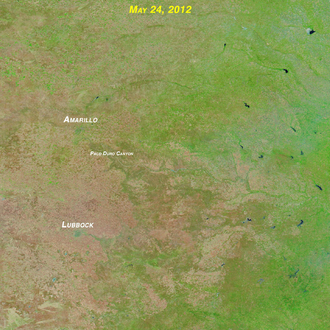
Two false-color images from NASA's Aqua satellite, one from May 24, 2012, and the other from May 5, 2014, show the evolution of drought in Texas and Oklahoma. Green is indicative of vegetation. (Images: NASA. Animation: Tom Yulsman) In the already parched Plains of the United States, intense drought "seems to be waking up and pushing rapidly north along with warmer temperatures." That's the grim assessment, issued yesterday, from the U.S. Drought Monitor. The bullseye of this expanding misery is Texas, large portions of which have been in drought for close to four years. As of this week, 21 percent of the state is categorized as being in exceptional drought — the most intense of the Drought Monitor categories. That's up from 13 percent a year ago. Overall, more than 80 percent of the state is experiencing some degree of drought. The animation above, centered on the Texas Panhandle and ...
Intense Drought Tightens Grip, Spreads To the High Plains
Explore the Texas drought evolution as satellite images reveal worsening conditions and exceptional drought impacts in Oklahoma.
More on Discover


Stay Curious
SubscribeTo The Magazine
Save up to 40% off the cover price when you subscribe to Discover magazine.
Subscribe