

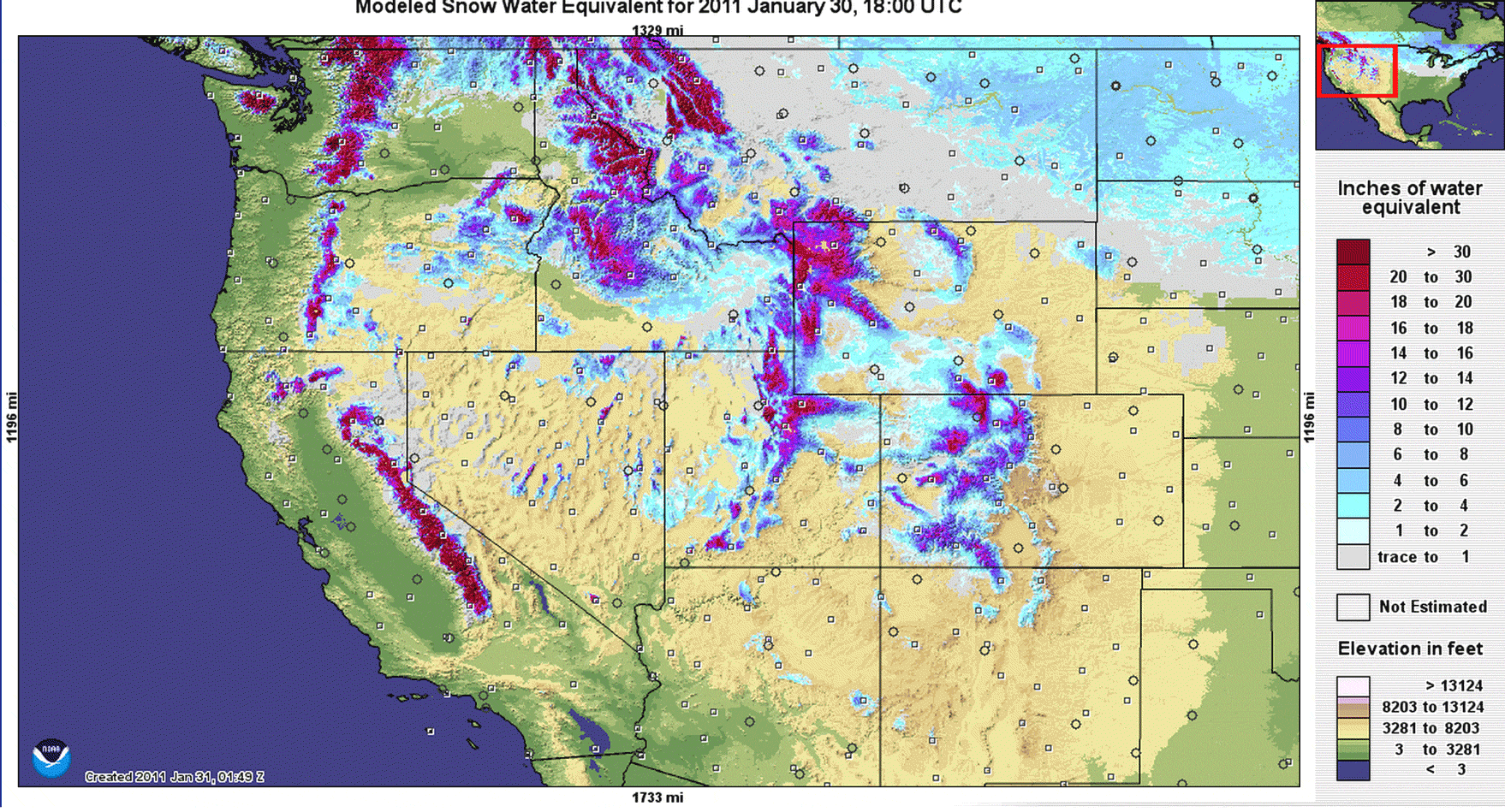
An animation showing snowpack in the western United States compares conditions at the end of January, 2011 and this year. (Maps: NOAA NOHRSC; Animation: Tom Yulsman) January was not kind to snowpack in the mountains of the U.S. West — from which most residents of this part of the country derive their water. This week is about the half-way mark for snow season in the West, and scientists have fanned out throughout the region to measure the amount of water locked in snow — a measure called "snow water equivalent." This is a monthly ground-truthing exercise to back up an automated monitoring system called SNOTEL. What they've been finding, combined with SNOTEL and drought data, is concerning. I created the animation above to provide a visual sense of what's happening. The first frame shows the snow water equivalent in the mountains of the West at the end of January 2011, when drought was absent from most of the region and conditions were closer to the long-term average. The second frame is from today. The change is pretty obvious.

Click on the thumbnail image at right to get a visual sense of how drought conditions have changed each year from 2011 to the present, as measured at the end of January. According to the U.S. Drought Monitor, here's where things stand as of this week,:
Continuing the pattern for most of January, the week ended with warm and mainly dry conditions over the western United States. Temperatures were 5-10 degrees Fahrenheit above normal, and only portions of northwest Washington and eastern New Mexico recorded any precipitation of significance.
The worst news comes from drought-ravaged California, where January saw almost no precipitation in the Sierra Nevada mountains. Statewide, snow water equivalent was just 25 percent of the long-term average for January 29th. The following animation compares California snowpack at the end of January 2010, and today:

California snowpack compared: 2010 and 2015. (Maps: NOHRSC; Animation: Tom Yulsman) In 2010, snowpack was a little above normal in four of six California regions, and below normal in the other two. The difference between then and today is simply shocking. While a series of December storms boosted reservoir storage in northern California, snowpack didn't improve much that month — and since then it has declined, according to Frank Gehrke, Chief of the California Cooperative Snow Surveys Program:
And so whatever reservoir storage we gained during December, we're gonna' go through it pretty quickly. And with this paltry of a snowpack, the runoff is gonna' be pretty, pretty sparse.
(For a video about this week's snow survey in California, including the interview with Gehrke from which these quotes were excerpted, go here.) The bottom line is that it doesn't look like California will escape from a fourth straight year of drought. In other parts of the West, conditions aren't nearly as grim, and there is still time to make up for lost ground. Even so, there's reason for concern. In the Pacific Northwest, "snowpack has been on a substantial decline," writes Cliff Mass, an atmospheric scientist at the University of Washington. High temperatures and lack of snowfall have been to blame. Here in Colorado where I live, we're not doing as well as last year:

Colorado's snowpack compared: Jan. 2014 and today. (Maps: NOAA NOHRSC; Animation: Tom Yulsman) At this point in the season last year, snow water equivalent in the mountains statewide, as measured by the SNOTEL system, was about equal to the long-term median. (We went on to have a very good year.) As of today, we're at just 80 percent, with the southwestern portion of the state suffering particularly badly. In Colorado, March is typically our snowiest month. Moreover, the southern half of the western U.S. stands a greater than 50/50 chance of above normal precipitation between now and the end of April, including about half of California, according to the latest outlook from the U.S. Climate Prediction Center. On the other hand, that same outlook forecasts drier than normal conditions in the Pacific Northwest. Time will tell. And I hope I will be able to make some animations in April that are more reassuring.


