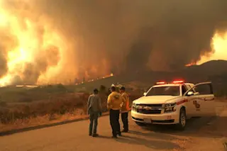
Smoke and heat from raging wildfires in Idaho and Montana are seen in this animation of satellite images acquired on Sept. 3, 2017. (Source: RAMMB/CIRA)
Note: I've updated this story to clarify and expand on the role of human-caused climate change in western wildfires. See below.
As of this afternoon, 77 large fires are burning across 1.4 million acres in eight western U.S. states. That's an area more than three times the size of Houston. The burning is part of a long-term trend of increasing wildfire in the West, brought on by a variety of factors, none more significant, according to recent research, than human-caused climate change. Hardest hit by fire right now is Montana, with 26 large wildfires blazing today across 662,105 acres, according to the the National Interagency Fire Center. The animation above, consisting of imagery acquired by the GOES-16 weather satellite on September 3, 2017, shows enormous ...


