On a wintry December day, in a farmer’s barn tucked into the English countryside, Peter Welch was setting out snacks for fellow metal-detector enthusiasts when one of them came in and said, “You’d better have a look at this.”
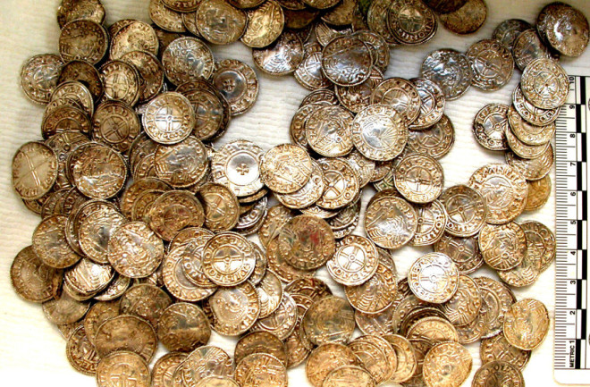
Welch tramped up a hill to where half a dozen people gathered around a freshly dug hole. In the cold ground was a handful of 11th-century coins, the first of more than 5,000 that would be found at the site as the excavation progressed. The discovery — one of the largest hoards of Saxon coins ever found in the United Kingdom — could be valued at more than $1.5 million.
For Welch, founder and owner of the Weekend Wanderers Detecting Club, the sheer thrill of the find was the proverbial pot of gold at the end of a rainbow called Google Earth.
The descendant of a CIA-funded project, Google Earth has become arguably the most popular — and ubiquitous — open-access satellite-imagery program in the world. Since its public launch in June 2005, Google Earth — with its virtual globe and street view capabilities — has found its way into driving directions, real estate presentations, study plans, online games such as GeoGuessr and flight simulators.
Google Earth has also revolutionized, for better and worse, amateur archaeology. In December 2014, for example, the same month Welch’s group found the coin hoard, another amateur archaeologist used Google Earth to locate a Bronze Age burial site in the eastern English county of Suffolk. Two months earlier, an enthusiast in southwestern England discovered still another Bronze Age site, possibly a farm, after scouring satellite images online.


