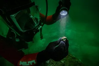
If for some reason you haven't been invited on a submersible ride-along, the next best thing is probably 340 miles' worth of raw video footage from the ocean floor. The U.S. Geological Survey just released a whole mess of data from its California Seafloor Mapping Program. Together with many partners, it's working on building maps of the California coast that include seafloor depth, habitat type, and other geological features. There's also video footage from cameras towed a few feet above the seafloor, as well as 87,000 still photos taken at regular intervals. At the project's website, visitors can explore an interactive map that's layered with whichever types of data interest them. I know somebody out there is into bathymetry, but I opted to explore the library of photos and videos. Below is a selection of things I spotted. The videos are kind of tedious but will reward the patient viewer with an occasional sea cucumber or alarmed fish. And the up-and-down bouncing of the camera as it travels over the seafloor might induce seasickness, so I'm guessing it's a realistic experience. If I ever get that invitation, I'll let you know.
Local color.
Cauliflower trees (disclaimer: I am not a marine biologist)...

 Explore All Options
...which the camera smashed into.
Scientists!
Crabs making friends with starfish.
An ex-starfish? Note the impression in the ground. Maybe it got friendly with the wrong arthropod.
Further evidence for my theory that at the bottom of the sea, everything is either terrifying...
...or shaped like a penis. (What? I edit a kids' science magazine. YOU try finding a photograph of a bone-eating worm that's appropriate for 12-year-olds. Go Google it right now. I'll wait.)
We crashed into the ground again. Maybe the little crabs that keep scurrying away from the camera have the right idea.
Fodder for the future BuzzFeed article "45 Ocean-Floor Animals That Are Totally Waving Hello."
And something incognito. Does anyone know what it is?
Golden, Nadine E., & Cochrane, Guy R. (2013). California Seafloor Mapping Program video and photograph portal U.S. Geological Survey data set : 10.5066F7J1015K
Images: Golden, Nadine E., and Cochrane, Guy R., 2013, California Seafloor Mapping Program video and photograph portal. U.S. Geological Survey data set, doi.10.5066F7J1015K